
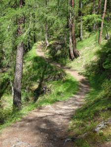
Below is a brief description of each walk. Click on the walk heading or image to see:
- an outline map with height profile,
- a gallery of photographs taken on the walk and
- a detailed description of the route.
Whichever walk you choose, you will not be disappointed. Enjoy!
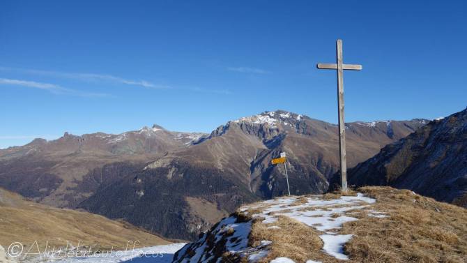
11. Thyon Ridge Walk

Although not strictly in the Val d’Hérens, this is without doubt one of the finest walks in the area, so it is included for that reason alone.
From Thyon, the initial climb is quite steep, but it soon levels out and you will be rewarded with a fine walk, which undulates along the ridge, gradually gets higher. It gives incredible views in all directions, including Mont Blanc, the Eiger (on a good day) and the Matterhorn.
The walk can be extended up to 11.5km and 970m of ascent, by continuing along the ridge to Crepon/Greppon Blanc. (See Route description).
Note that the ridge is not particularly vertiginous, e.g. there are no vertical drops, but some people may find the odd short section unnerving, as the slope goes away on one or both sides. However, if you have only one opportunity to do a high level walk in the region, make sure this is it!
Distance: 8 km
Height gain: 600m
13. Eison Loop, from Evolène
After an initial climb to Volovron, the path undulates nicely through the woods to Eison, giving occasional, but fine, views across to the far side of the valley. The return is via a lower path which takes in the Chapelle de la Garde.
Distance: 12.25 km
Height gain: 630m
15. Alpage de l’Etoile

An alternative to walking up to Villa, La Sage or La Forclaz, is to take the path up to the alpage on the opposite (west) side of the valley. During the summer, there are numerous butterflies and flowers to be seen.
There is also a hidden gem along the route, in the form of Le Tsalè de la Cretta.
Note that, if legs and feet are getting a little tired, the last climb to the Les Chottes de L’Etoile can be omitted, (saving 100m of ascent) and/or the bus can be caught back to Evolène, (saving 3.5km of distance).
Distance: 14.1 km (max)
Height gain: 925m (max)
17. Tsalè de Bréona from La Forclaz
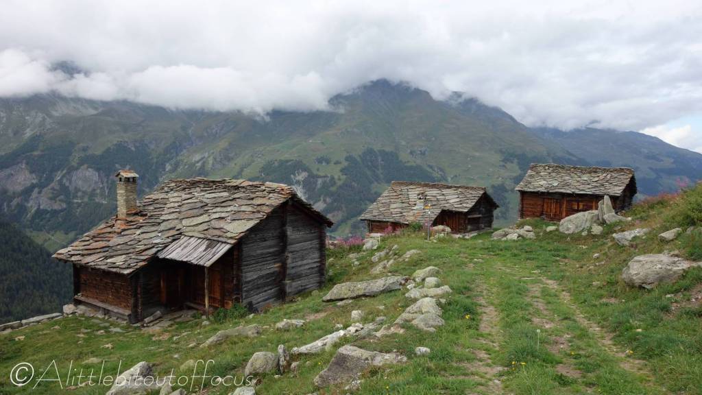
This walk gives fabulous views of the Ferpècle valley and takes in many of the old traditional buildings on the Bréona alpage.
It can be shortened (and height gain reduced), by taking either of the two alternative paths to Tsalé de Tsaté, or lengthened by walking down to Les Haudères or Evolène.
Distance: 6.5 km
Height gain: 545m
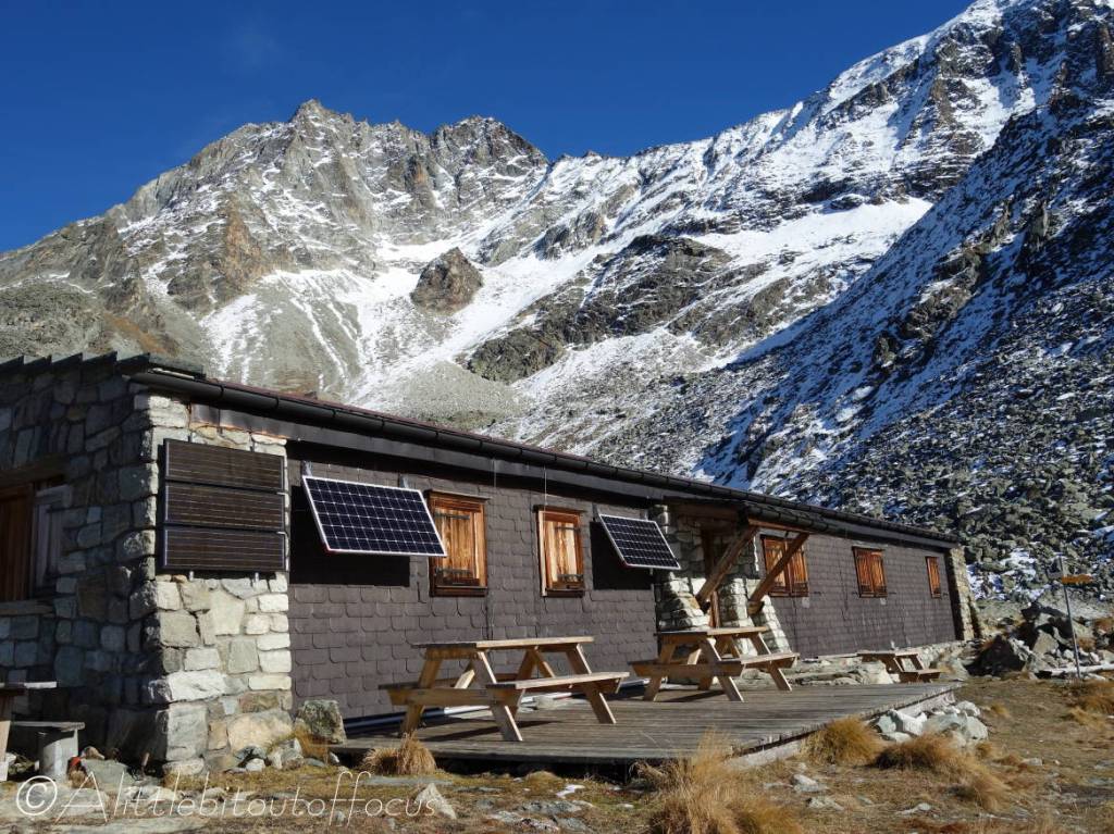
19. Bricola Hut
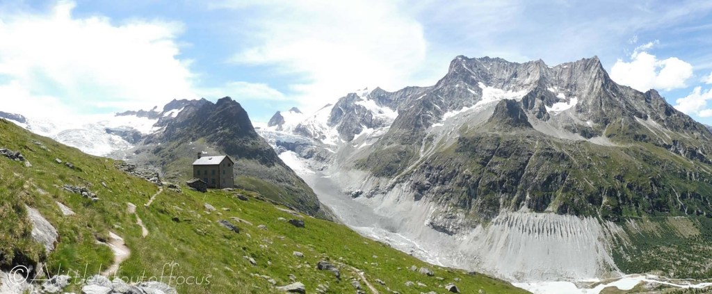
Perched high above the Ferpècle valley is a building which was once used as a mountain hut. Like many huts, it was built in a fabulous position, with fantastic views, of both the valley itself and the huge Ferpècle glacier. Some naturally growing Edelweiss can also be seen nearby.
The walk can be extended further up the left hand side of the valley, if required, but the return is the same way, with a slightly different route back to the parking area along the valley floor.
Distance: 8.7 km
Height gain: 660m
21. Les Haudères to Arolla
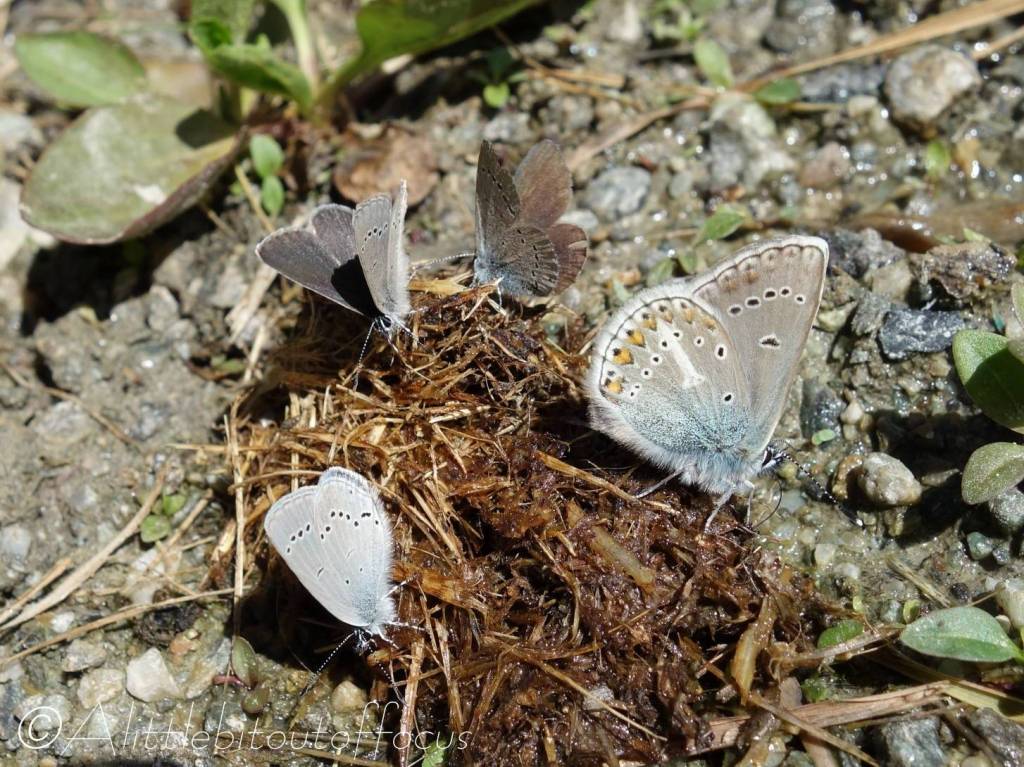
If you are looking for something a little bit different, with exercise in mind, or if you simply prefer walking uphill to downhill, then this may well be the walk for you.
It takes in the hamlets of La Gouille, (Satarma, optionally), Pramousse and La Monta before reaching Arolla. The ascent is initially quite steep, but there are a host of flowers and butterflies to capture your attention and perhaps give you a little rest along the way.
Of course, the route can be reversed to make it much easier.
Distance: 7.9 km
Height gain: 675m
23. Cabane de la Tsa Walk
This circular walk can be done in either direction, but the climb from Arolla is less steep, so that option is described here. During the ascent, don’t forget to keep looking back as the valley floor disappears into the distance.
The cabane is open during the summer, but please check their website, if you are looking to stay or have something to eat. There is a short, rocky scramble (marked by red paint) across to the descent path. And, although the way down is quite steep, it’s not vertiginous in any way.
Distance: 9.25 km
Height gain: 810m
12. La Luette to Passarelle de la Combe and Euseigne

This is a very peaceful walk, which undulates along the east side of the valley. It crosses the Passarelle de la Grande Combe before passing Ossona and dropping down (steeply) to Combioula, where there is a natural hot (well, warm) spring.
In summer there are many butterflies to be seen, including the rare and, in some countries, protected Apollo.
Distance: 10.6 km
Height gain: 550m
14. Pic d’Artsinol (@2,998m/9,836ft)
Although not quite reaching 3,000m, this is one of the finest walks and viewpoints in the area, which is made much more achievable in the summer by taking the chairlift up to Chemeuille from Lanna. (Hence it makes the Medium category).
The walk is not too taxing until you reach the quite steep climb before the col. It’s well worth the effort of getting even to the col as, just a short way up the ridge, you get a fabulous view of the Dixence dam.
Be sure to check the time of the last lift, if you are not planning on walking back down to Evolène.
If the chairlift is not running, then it’s a good 700m extra climb AND descent, so it does become quite a challenge.
Distance: 11.1 km
Height gain: 890m
16. Mayens de Cotter from Evolène
If you are looking for a suitable walk to do in the late Spring, when the snow has not yet melted away, or on days when there’s low cloud cover, this walk can come to the rescue.
It’s quite a stiff climb up to the Mayens de Cotter, but from there it’s a very pleasant stroll along a track at a little over 2,000m. There is another short climb before descending via La Forlaz back to the start or to Les Haudères if you prefer.
Distance: 12.8 km
Height gain: 980m
18. Roc Vieux from Les Haudères

The Evoléne/Les Haudères valley is dominated by the the “Twin Peaks” of the Grande and Petite Veisivi. Who cannot have looked upwards and thought “Wouldn’t it be great to look down on the valley from up there?”
Well, it is possible, though not from the top (unless you are a climber). About half way up, where the tree line stops, is Roc Vieux.
While it can also be done from the Arolla road, the route described here is from Les Haudères.
Distance: 11.85 km
Height gain: 950m
20. Aiguilles Rouges hut from Arolla
Without a shadow of a doubt, this is one of the finest walks in the area. It has everything you could wish for; a picturesque hamlet, glacial outflow, numerous flowers and butterflies, small lakes and a mountain hut, all with views to die for along the way.
But, be aware that it’s a long and quite steep descent from the hut to La Gouille. And, if parking at Arolla, you will need to catch the bus to pick up your car.
Distance: 10.5 km
Height gain: 830m
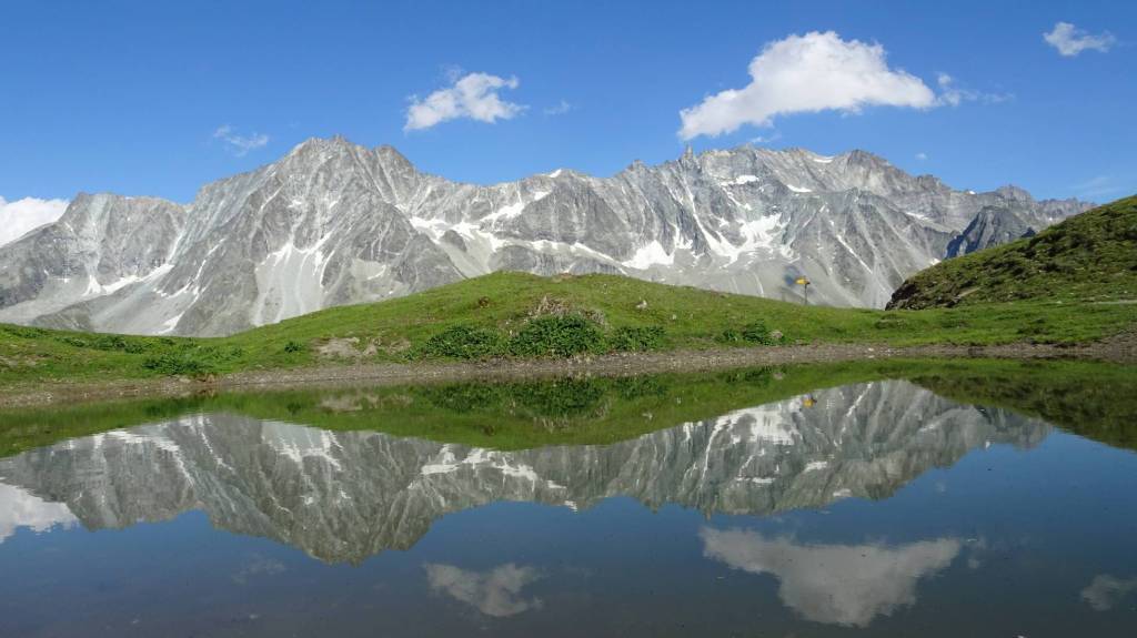
22. Lake with no name

High above Arolla, quite near to the top of the upper ski lift, there is a small lake which is unnamed on the maps. It does however provide a good destination for a ‘different’ walk, which will almost certainly be quiet and you may be rewarded with one of those classic ‘reflection’ photographs with the mountains behind.
Note that the lake is covered in snow in the winter and frozen for most of the Spring and, sometimes, even early summer. So late summer/autumn is the best time to do this walk.
Distance: 12.25 km
Height gain: 840m
24. Plans de Bertol
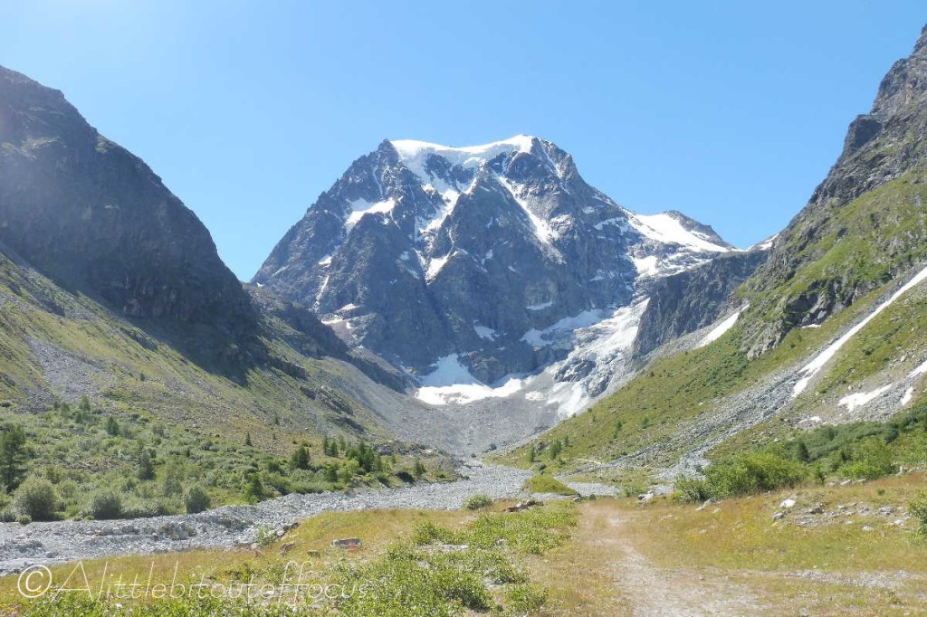
Another walk starting from Arolla, takes you up the valley towards Mont Collon and gives you a magnificent view of its glacier.
After a gentle start, the path climbs quite steeply up to the left to an almost flat area, called the Plan de Bertol. It’s a very peaceful place to stop for a picnic and take in the view of the Cabane de Bertol perched high up on the ridge.
From there, to make the walk a little longer, it is possible to ascend further up towards the cabane and return the same way.
Distance: 10.9 km
Height gain: 710m
