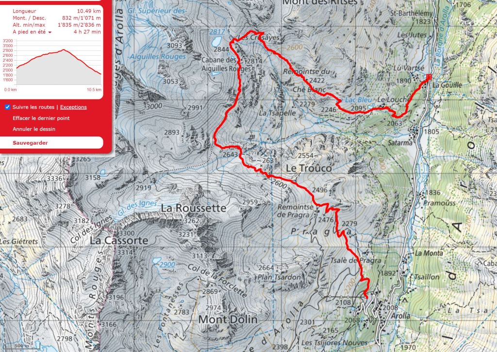
Outline Map:
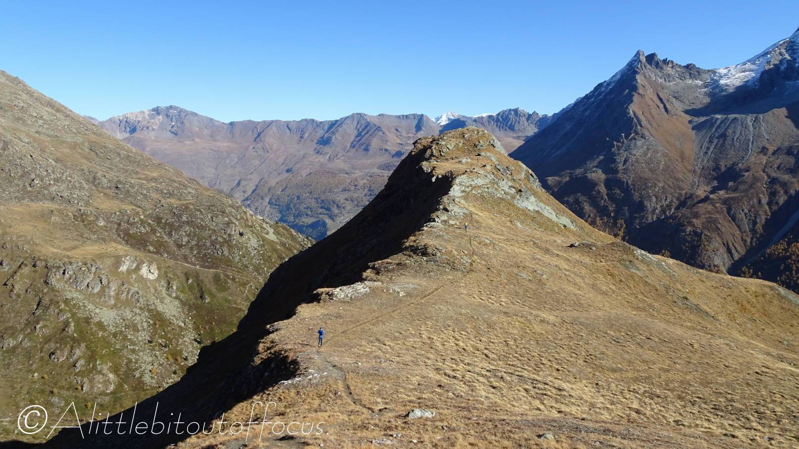
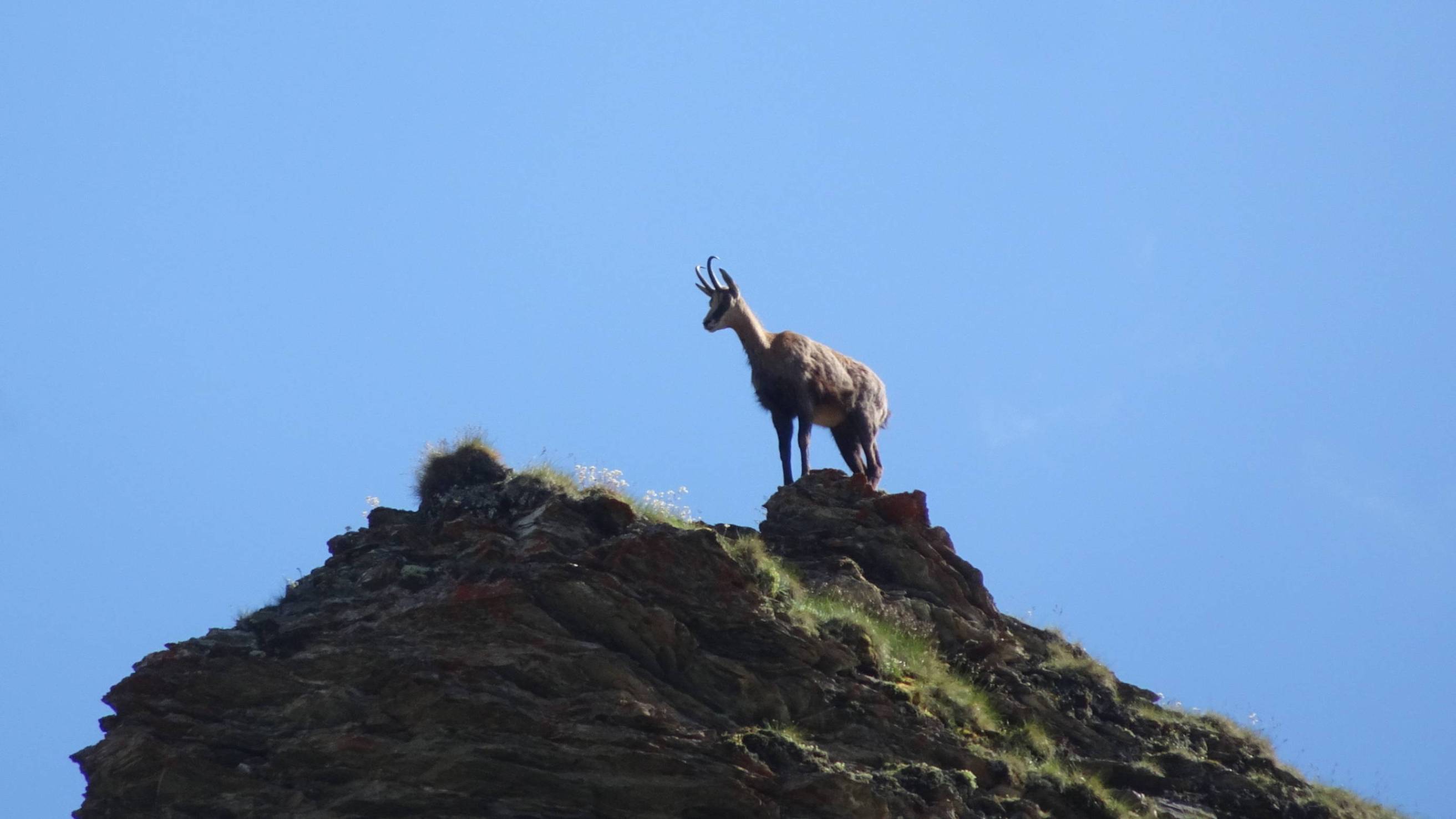
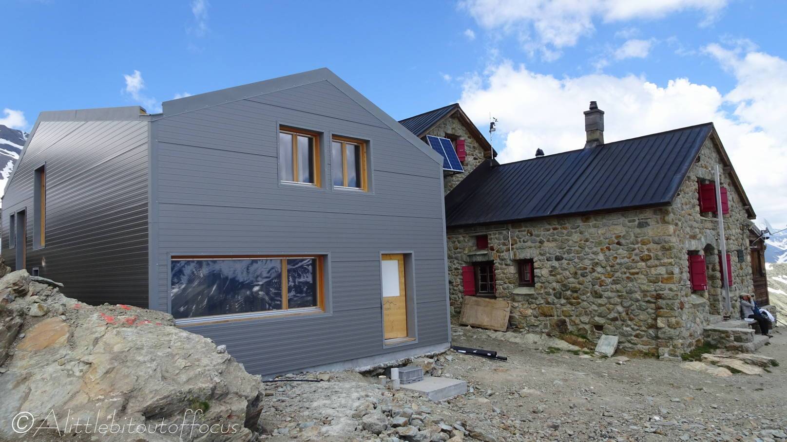
Gallery:


Route Description:
Walk 20: Aiguilles Rouges Hut from Arolla (Distance: 10.5 km and 830m ascent)
The start point for this walk is the small car park just above the Arolla village*, though it can be done from the village square if catching the bus – simply walk up the road to the parking area. It finishes in La Gouille, but it is possible to walk back to Arolla, either retracing your steps from the hut, or by taking the undulating path from Lac Bleu. Alternatively, and perhaps the best car option, is to time it so that you park your car at La Gouille and then catch the bus up to Arolla.
(*Turn off the road and down to the right about 80 metres after passing the bend in the road and entrance to the Kurhaus Hotel).
- At the far end of the parking area, on the other side of the ski lift, the path ascends to the left. After only a short climb you will see a signpost, ignore the right turn (to La Gouille) and continue upwards. The path splits into 2 but either way takes you up to a wide track. Turn right here and, as the track does a U turn to the left, continue straight ahead along the path to the right hand side.
- As you exit the woods, the path splits but, again, either route is OK and you reach another wide track. Turn right here for around 100m to a sort of track junction. Take the path directly opposite and slightly to the left. This path heads upwards in the direction of a wooden hut on the horizon. At a big rock, turn right through a ‘sprung’ gate. Soon after a left turn, the path widens into a track. Follow this as it winds up, or take a slight short-cut path on the right.
As the path bends to the left, follow the signpost direction and go right. Again there’s a shortcut path on the right. This meets a rough stone track just below a chalet. Turn right here. The path turns left then right to a signpost marked as Remointse de Pra Gra. - Remointse de Pra Gra
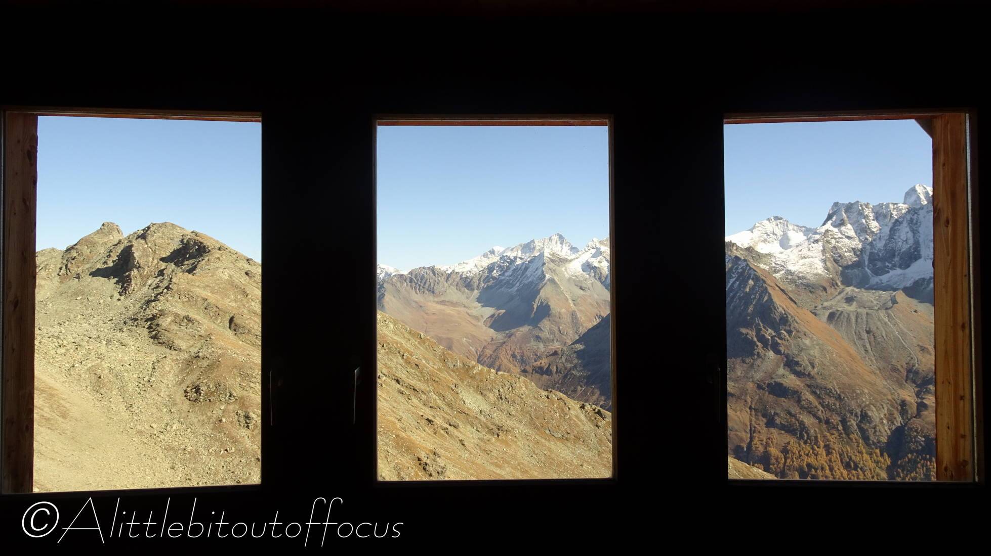
Follow the path, as signposted, up to the right. It then bends to the left, away from the main valley. The rocky (and only) path is now quite clear as it winds its way upwards and away from the valley. Note that the route and Aiguilles Rouges hut can be seen in the far distance. Look out for, and cross, a rickety bridge and red painted signs, indicating the way through a rock field. The path eventually flattens out and traverses across some scree before rising again (twice) up to the hut. - Aiguilles Rouge Hut
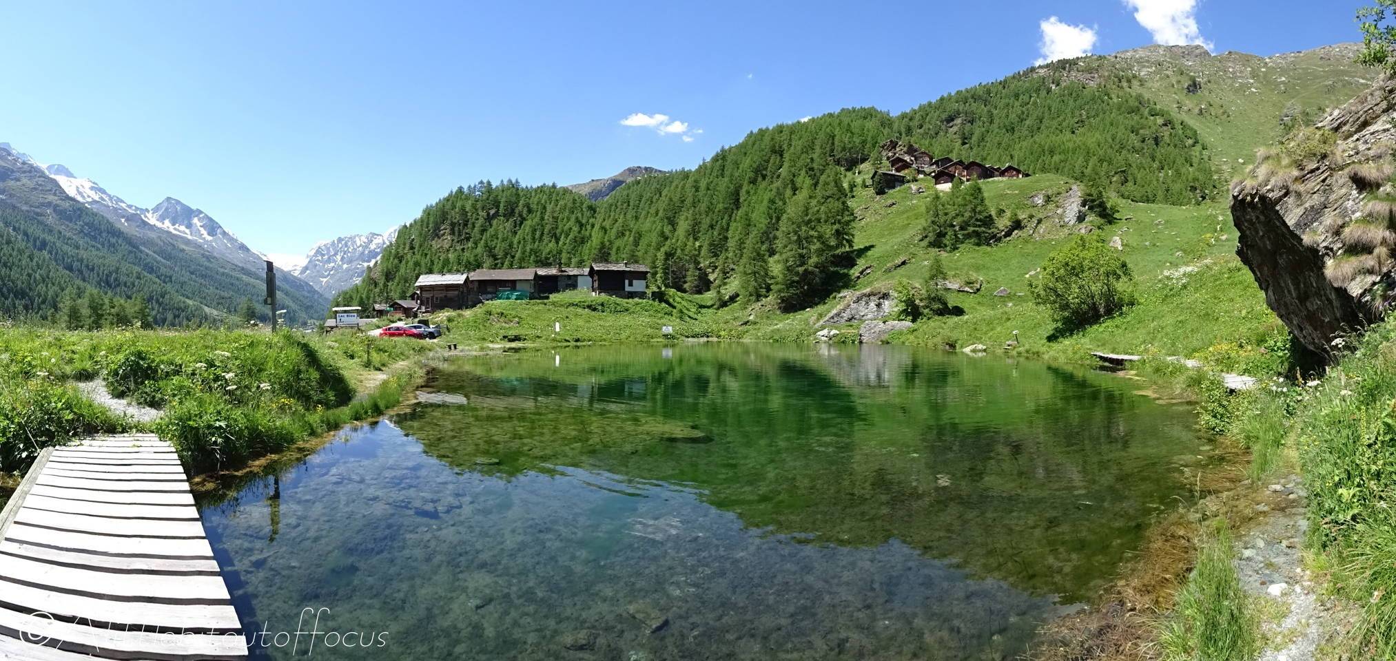
As you reach the hut, you will see a signpost. The path down runs off to the left of the hut (from the original direction of approach), signposted Louché (Lac Bleu) and La Gouille. Again the path down is quite clear, as it descends initially quite steeply to cross a small stream. Turn right immediately after the stream and follow the path down, again quite steeply at times. Occasionally the path splits but all paths lead to the same place – down the valley. After maybe 40 mins of descent the path goes through a few trees before emerging at Lac Bleu. - Lac Bleu
Follow the path around to the right and far side of the main lake, cross the small wooden bridge over the stream and turn right. The path descends towards the valley floor before sweeping around to the left and through some trees to La Gouille. Here there is a café/restaurant and a postbus stop to return to Arolla or Evolène.
