
Below is a brief description of each walk. Click on the heading or image to see:
- an outline map with height profile,
- a gallery of photos taken on the walk and
- a detailed description of the route.
Whichever walk you choose, you will not be disappointed. Enjoy!
25. Val de Réchy
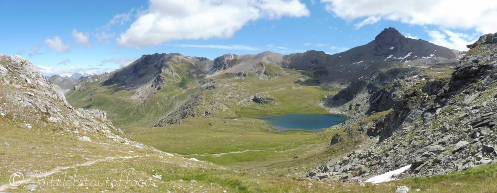
The Val de Réchy is a haven of peace and quiet. There are no roads and no houses, it’s just nature in its purest form. Quite simply – beautiful!
The walk, as described here, requires a drive, or postbus, to Trogne, where the path climbs through woods and open pasture to the Pas de Lovégno. From there the path drops into the Val de Réchy, where there’s a small lake, before continuing along the valley floor, passed another small lake, to the Col de Cou. The route then descends to the Gîte de la Louère (refreshments available in season) before returning along the east side of the Val d’Hérens back to Trogne.
Distance: 17.85 km
Height Gain: 1,430m
27. Sasseneire (@3,253m)

If you come to the Alps to stand on the top of mountains, then this walk is a MUST! While it can be made easier by starting from Villa, reaching the top from Evolène is a real challenge.
For pure walkers, as opposed to climbers or mountaineers, it’s the 2nd highest peak achievable in the valley (after Mont de L’Etoile – see Walk 32).
Note that it’s best walked in the mid to late summer/early autumn, when the snow has disappeared from the tops, but even then, care must be taken along the ridge to the summit.
Distance: 18.6 km
Height Gain: 1,860m
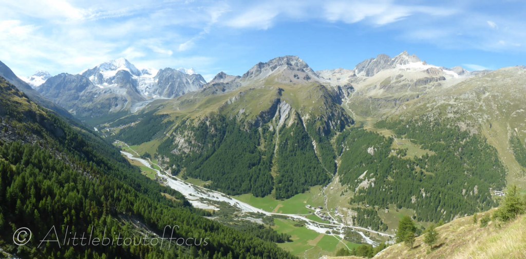
29. Pointe du Tsaté (@3,077m) from La Forclaz

Another 3,000 metre peak which can be ‘bagged’ quite readily, is the Pointe du Tsaté. Starting from La Forclaz, the climb is relatively straightforward and, from the summit, you get amazing views into the Val d’Anniviers and the incredible range of mountains to the south.
Distance: 10.9 km
Height Gain: 1,385m
31. Col de Tsarmine
The end of the Evolène valley is dominated by the ‘twin peaks’ of the Grande and Petite Dents du Veisivi. Anyone looking up at them must wish they could climb to the top but, unfortunately, even the smaller Petite Dent requires climbing equipment to get to the summit.
This walk does the next best thing which is to walk to the col between them – which is still at a height of 3,050m.
Distance: 8.2 km
Height Gain: 1,275m
33. Lac des Dix to Arolla

This walk takes you from the foot of the largest gravity dam in the world, the Dixence dam, 7 km along the side of Lac des Dix and then across to scale the infamous ladders at the Pas de Chèvres, before dropping down into Arolla.
The end of the Héremence valley is a wild environment, punctuated only by the presence of the Cabane des Dix, which could be used as an overnight stop off point, before continuing across the glacier to Arolla – thus making it into a 2 day trek
Distance: 18.9 km
Height Gain: 980m
26. Pas de Lona and Becs de Bosson cabane from Evolène
Although this is a long and demanding walk, it gives a great sense of what the Val d’Hérens has to offer – with breathtaking views almost all the way along.
Thankfully, there’s not just one, but three opportunities to stop for refreshments en route (in season of course).
L’A Vielle and the Pas de Lona are also good targets in themselves for a good days walk from Evolène.
Distance: 21.1 km
Height Gain: 1,765m
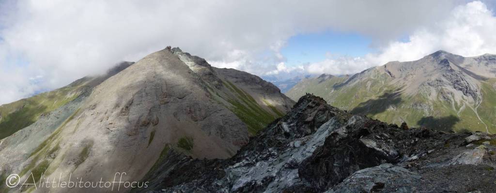
28. Col du Torrent to Pointe du Tsaté ridge

For anyone who loves tackling (non-precipitous) ridges, especially at around 3,000m, this could well be the walk for you! Though, please note, it is quite demanding in terms of both the distance and height gained.
It follows the same route up from Evolène to the Col du Torrent (as in Walk 27) but then turns right until you get to the Pointe du Tsaté. The route then descends the same way as Walk 29 to just above La Forclaz before turning off to La Sage and, finally, Evolène.
Distance: 18.9 km
Height Gain: 1,810m
30. Col de Bréona and Col du Tsaté (from La Forclaz)
There are six obvious ways to cross over into either the Val de Réchy or the Val d’Anniviers from the Val d’Hérens; four of them are the Col de Cou and the Pas de Lovegno, (see Walk 25); the Pas de Lona (Walk 26) and the Col de Torrent (Walks 27 & 28). This walk picks up the other two.
Be aware though that there is a bit of a scramble between the two cols, so anyone without suitable experience (or with vertigo) may prefer to retrace their steps from the Col de Bréona.
Distance: 12.6 km
Height Gain: 1,275m
32. Mont de L’Etoile

At 3,370 metres in height, Mont de l’Etoile is the highest peak that you can climb in the valley without specialist equipment (or perhaps a qualified guide or climbing partner).
It’s best attempted in late summer or even autumn, when all the snow has disappeared from the tops. It provides fabulous 360 degree views.
Distance: 13 km
Height Gain: 1,535m
