Outline Map:

Gallery:


Route Description:
Walk 32: Mont de l’Etoile (Distance: 13 km and 1,535m of ascent)
As described here, the walk goes to the top of Mont de L’Etoile and back again from La Gouille (or Satarma), but there are two alternatives, if you would like to make it a little easier, by including an overnight stay in the Aiguilles Rouges cabane. The first option is to follow this route, but turn left where mentioned to the cabane (section 4 below); the second is to set off from Arolla and follow the instructions of Walk 20 to the cabane.
From the cabane, the path drops down to the stream on the Mont de l’Etoile side before continuing as described below (again in section 4).
Note that parking at La Gouille can be an issue on busy days. If it’s full, or anyway, you can continue up the road towards Arolla and park on the left side of the road just past Satarma. An alternative path goes up to Lac Bleu to the left side of the row of chalets on the far right of Satarma.
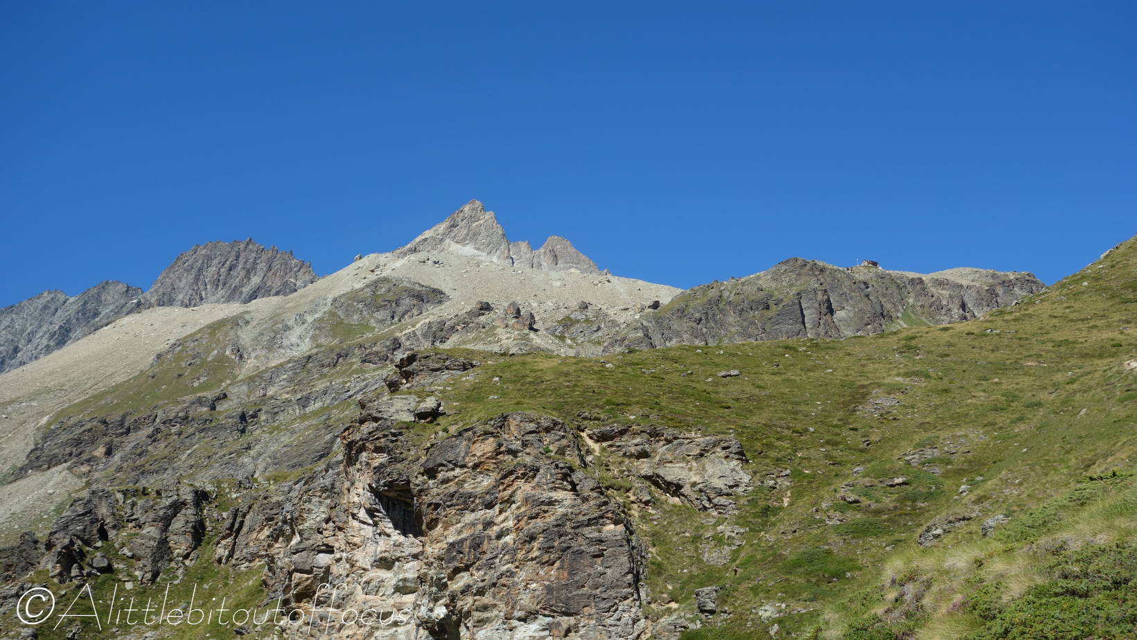
- Go up the tarmac road to the left of the small lake and to the right of the Lac Bleu sign. The road bends to the right then left before becoming a track. After the 3rd chalet, a path goes up towards a yellow sign. Turn left at the sign and follow the path up into and through the woods. Part of the way up there’s a fork in the path near a signpost. Take the left hand fork as indicated by the sign*.
- Soon the path emerges from the wood and crosses a small meadow. From here you have a wonderful view of Mont Collon and the Pigne d’Arolla. In addition along the ridge to the left, the Pointe des Genevois and the sharp point of the Aiguilles de la Tsa can be seen. The path now turns up to the right, quite steeply at times, before zigzagging to the right and then left towards some wooden buildings. One of these buildings is a buvette or café, where drinks and snacks can be found (in the summer only).
Continue upwards to the left of these buildings for another 100m to reach Lac Bleu. - Lac Bleu
Cross the small bridge over the outflow stream and continue up to the left. A signpost indicates the way – which is continue climbing upwards, initially through some trees, before the path begins to zig-zag to the right.
The path soon turns back to the left and then heads straight up the hill towards the hut, which should soon be visible on the near horizon. Along the way, you will pass an old barn (see pic 2) on the right and the Tete de Tronc viewpoint can be seen across to the left.
The path continues to climb, eventually along the right hand side of a stream. - Wooden Bridge
Soon you will reach a new wooden bridge, which crosses over the stream and the path on the other side takes you up to the Aiguilles Rouges cabane. Feel free to make a detour for refreshments and return if required.
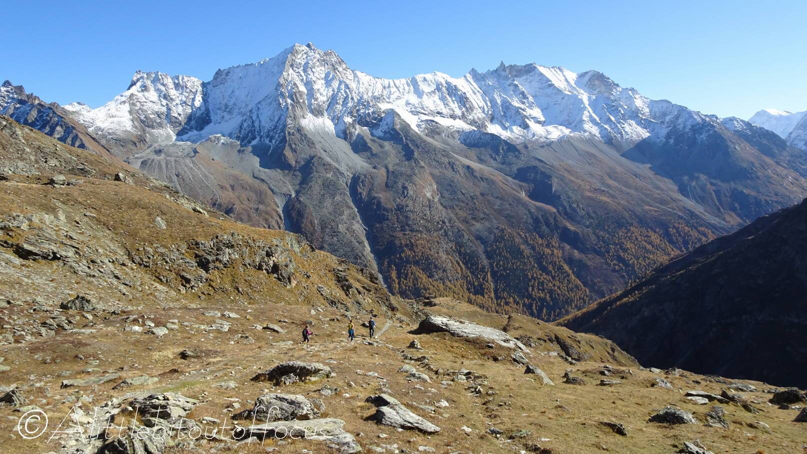
If continuing, do not cross the bridge, but continue along and upwards, soon veering off to the right. After a short while, the path turns to the left and runs along the crest of the glacial moraine. Mont de l’Etoile is now up high to the right.
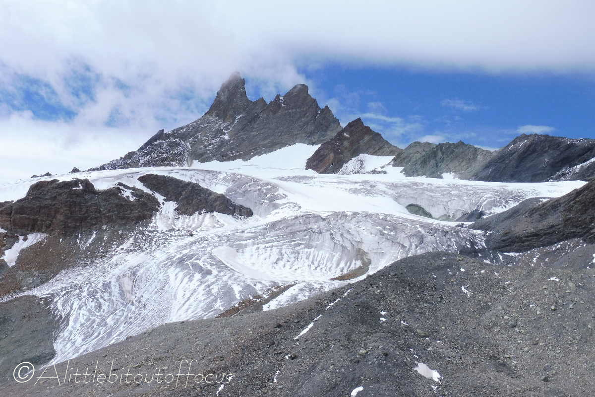
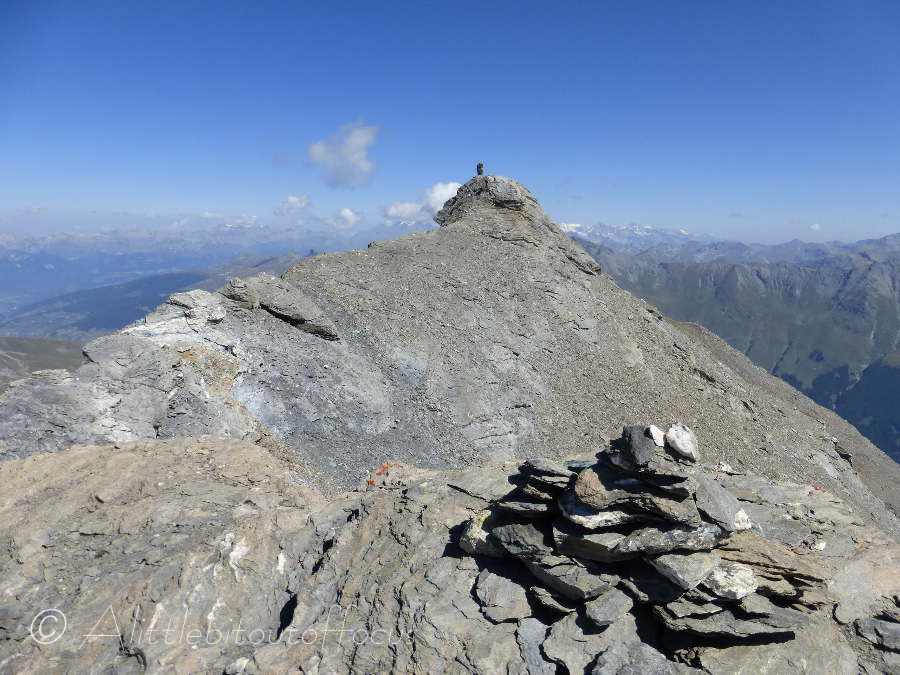
Part (maybe half?) way along the crest, there is a boulder and arrow pointing to the right. Turn right here and follow the path as it passes through a boulder field and eventually up some loose shale type rock. - Mont de L’Etoile summit
Be aware that the top is made up of 2 parts. The first is reached without difficulty but, to get to the second, you must navigate across a short and very narrow (and N.B. precipitous) ridge. Anyone with vertigo, or of a nervous disposition, should NOT attempt to reach the second summit, as it’s simply not worth the risk!
The views in all directions (whichever part you stand on) are spectacular. - Return to La Gouille (or Satarma or Arolla) the same way.
