Outline Map:
Gallery:


Route Description:
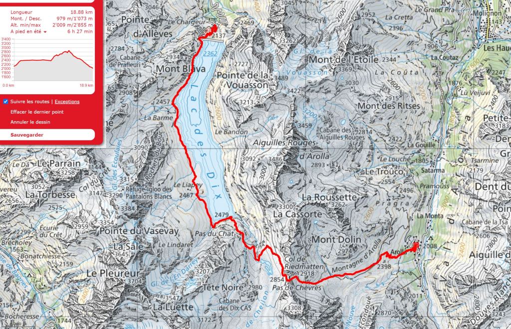
Walk 33: Lac des Dix to Arolla (Distance: 18.9 km and 980m of ascent)
Another walk which doesn’t quite ‘fit’ into the criteria – in terms of both height gain and being completely in the Val d’Hérens, but it’s a long walk into wild territory, so it makes it quite Challenging. You also have the additional challenge of getting to the start and maybe from the finish.
An alternative ‘Medium’ option is to turn it into a 2 day trek, from the Grande Dixence Dam to the Cabane des Dix and overnight there, before crossing the glacier to the Pas de Chèvres (following marked stones) and down to Arolla. Remember to book the accommodation at least the day before (and before 6pm).
- From the parking area beneath the huge wall of the Dixence dam, follow the road up and back to the right until you reach the bottom of the gondola lift up to the dam. Feel free to take this lift (and save yourself 300m of ascent) but dedicated walkers will want to head to the left of the Hotel/restaurant and take the path which runs up behind. (Signposted).
Very soon you will pass the Chappelle St Jean to your left. Continue up the zig-zag path until it levels out and then go across and up to the right of the dam – finally ascending a slope to the top of the dam itself. - Dixence Dam (top)
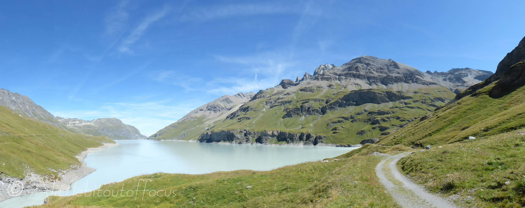
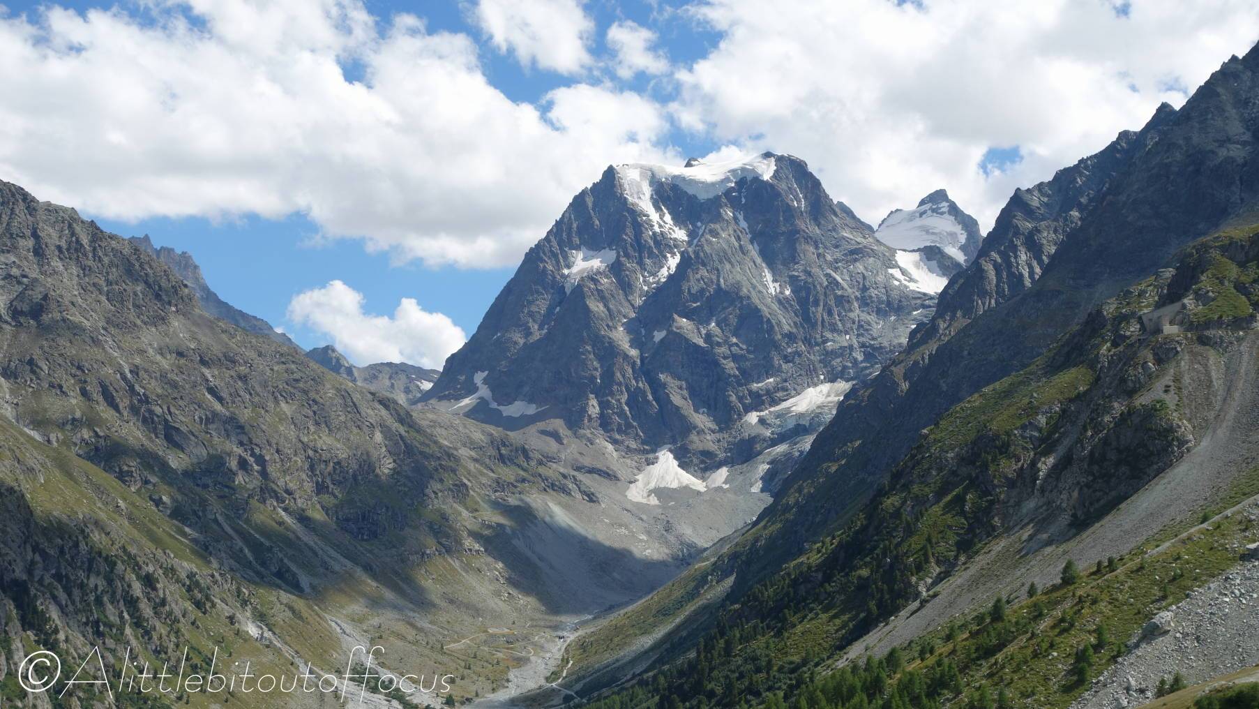
Follow the wide track which runs for around 7km alongside the right hand side (though well above) the Lac des Dix. There are two quite long tunnels towards the start, but be aware that there are light switches as you enter. Ignore the signpost on the right hand side after just over 2 km (indicating the way up to La Barme and Prafleuri) and continue along the track. - End of the lake
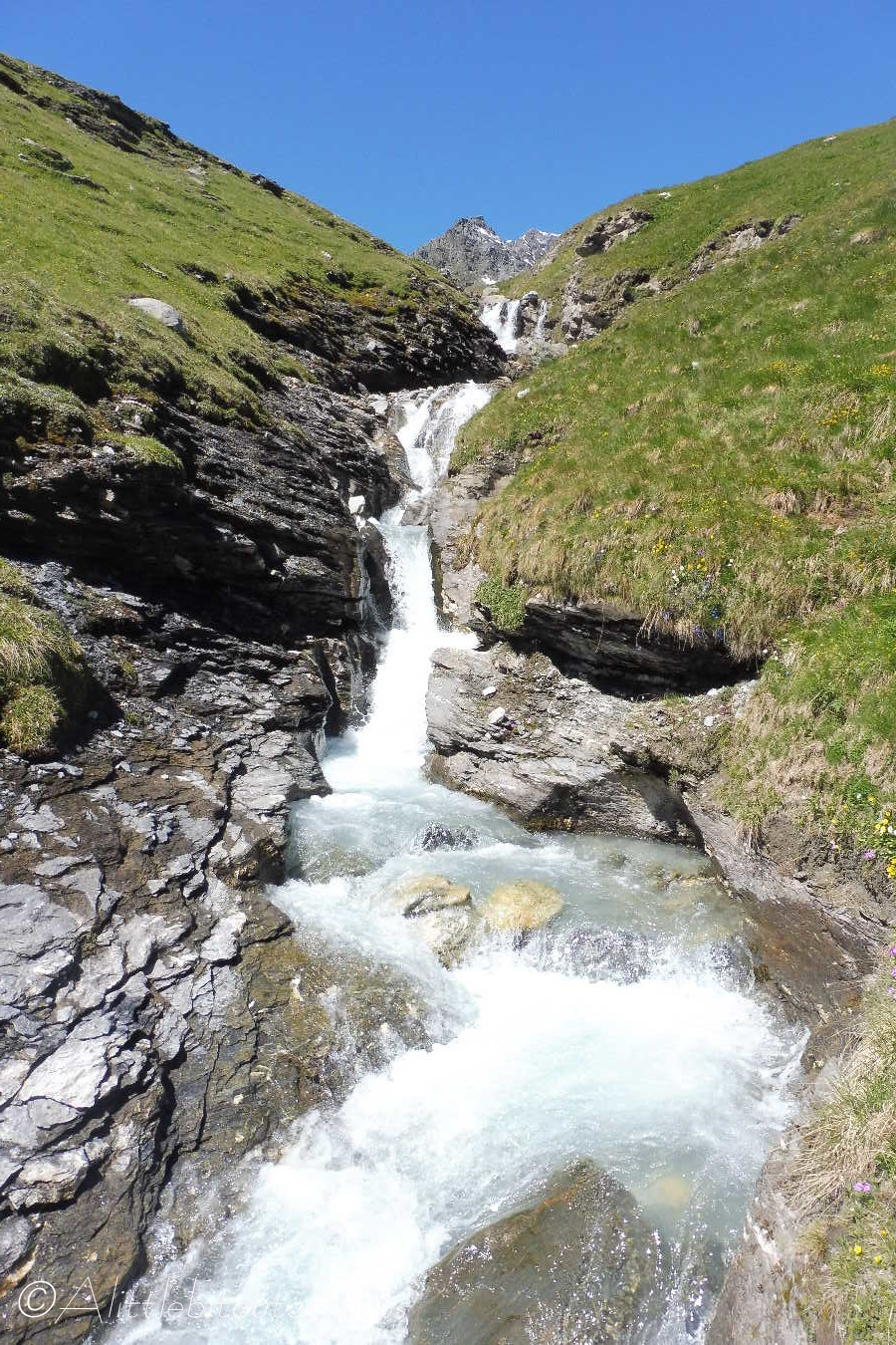
At the end of the lake, the track crosses a stream and then turns to the left, again along the lake. Just before you reach the far side of the lake, a path goes up and back on itself to the right. Follow this path as it climbs steeply up, ignoring any path off to the left (as this takes you to a where a bridge was washed away).
After about 1 km of climbing, the path becomes less steep. It then begins to climb steeply again (zig-zagging) up to a signpost. Turn left here (to Col de Reidmatten/Pas de Chèvres as opposed to straight on to the Cabane des Dix – unless you plan to stay there for the night, in which case carry on for another 1km and the path we veer off to the right and go around the Tete Noir to the cabane).
Follow this path down until it crosses a bridge over a stream and then turns right. After another 500m the path turns to the left and crosses some almost flat ground before going back to the right. The path ascends and then begins to drop again and, after around 1.2km from the right turn, the red and white markers will help to guide you up a steep, rocky scramble.
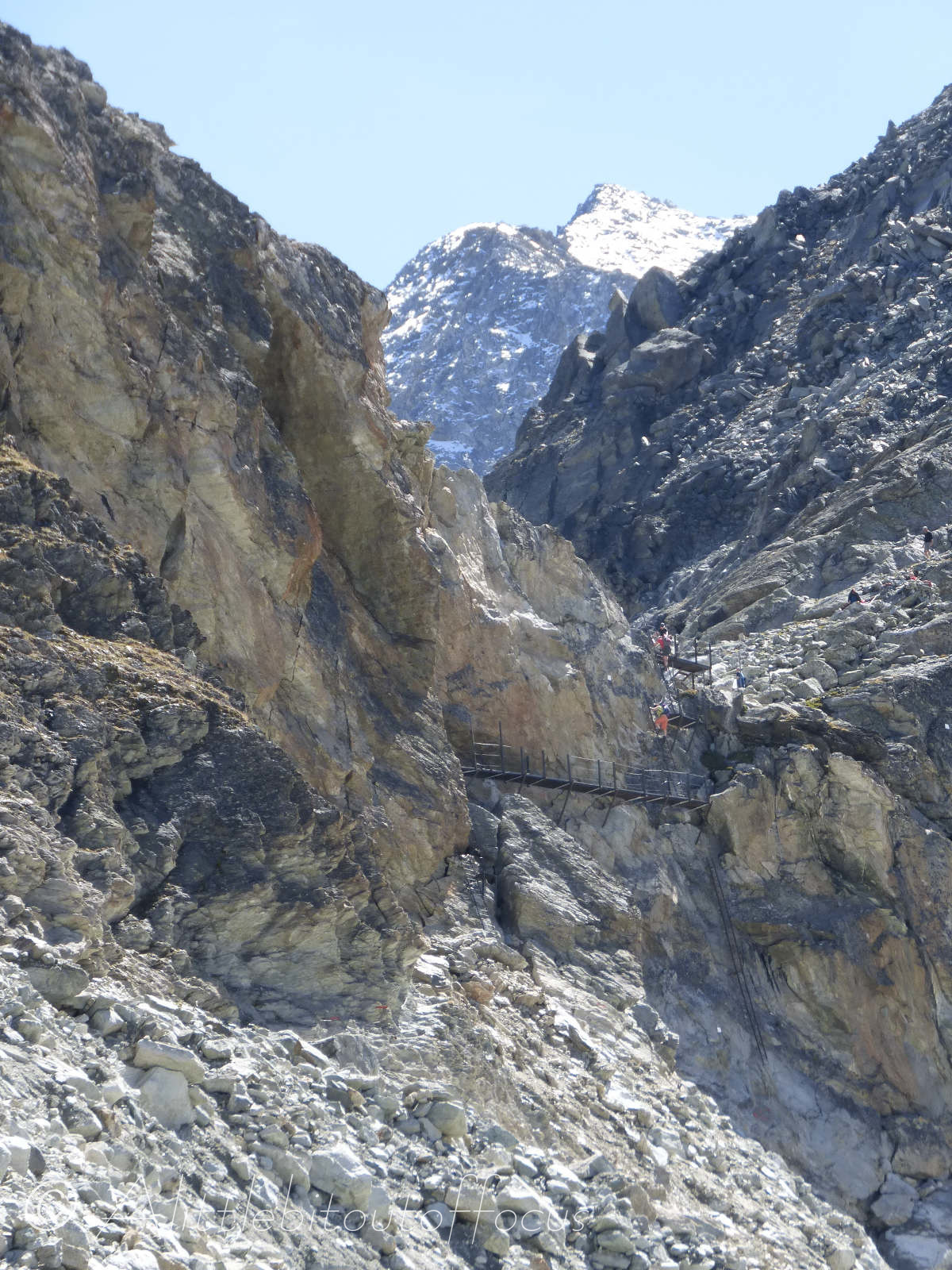
It is possible to continue scrambling up and over the Col de Reidmatten. But, note, it is a difficult scramble, so it’s much easier to turn to the right (after about 45m of ascent from the left turn/first scramble) and continue along the path for almost 200m to the Pas de Chèvres. - Pas de Chèvres
The old single ladder* has been replaced by a fine set of 3 smaller ladders with platforms in between. So it is now a relatively easy climb to the top of the pass. (Though still take care, especially in wet weather).
(*The old ladder is still visible if you look to the right of the new set of ladders).
Be sure to turn around and gaze across the glacier and spot the Cabane des Dix almost directly opposite, perched on a rock.
From the top the descent path is fairly clear, going off initially to the left before swinging back around to the right and then bending gradually to the left and down towards the Arolla valley. About 1.5km from the pass you will meet a track coming in from the left and almost immediately cross a stream. Turn right after crossing and follow the track down to some old/collapsed buildings at La Remointse. - La Remointse
While it is possible to turn left along a good track and follow it all the way down to Arolla (take this much less steep route if you prefer) but a signpost indicates a much shorter (and much steeper) route down – i.e. straight across and then going down slightly off to the right of the track. After 500m you can either continue onwards, or take a right turn and go down a multitude of zig-zag paths to a small building (sometimes open as a café in the summer). If taking this option turn left along the track towards Arolla.
All of the above options will lead you to either the road above Arolla (follow this down to the main square(postbus terminus) or to the Kurhaus hotel, which itself has a path down into the village (or you can follow the road too).
