Outline Map:

Gallery:


Route Description:
Walk 26: Pas de Lona and Becs de Bosson cabane (Distance: 21.1 km and 1,765m ascent)
As you might expect, this walk is highly recommended on a fine, blue sky day – to take advantage of the far reaching views. Occasionally the clouds can hang around the mountain tops (even if it’s clear over the valley) and it’s best to check that you will not be walking into mist before setting off. You will then be rewarded with some fabulous memories.
- Evolène to Volovron
From the Evolène Village bus stop (village side of the road), cross the road via the crossing and take the signposted path to the left of the chalet opposite. The path ascends to a road. Cross the road and go up the path opposite. This path soon turns to the right and emerges at a wide track. Turn left here and follow the track to a left hand bend near a stream/waterfall.
30 metres after the bend a path goes up to the right, take this to meet the road again higher up. Turn right for 40m and pick up the path again on the left. The path appears to fork – keep left. On reaching the tarmac road again, follow it around an S bend for around 500m then turn right up a path (signposted) to a renovated raccard/chalet. Follow the path up to the left of the chalet then go up through the middle of the wooden raccards, turning left towards Volovron/Eison (again signposted). Follow the grass track up to a wooden cross and turn left towards some buildings. (This is Volovron). - Volovron
Just beyond the last wooden building on the right, there is a signpost. Turn right here, and go up to the left of the aforementioned wooden building. The path continues to climb quite steeply, zig-zagging left and right, but soon heads directly up the slope to another signpost. Turn left here into the woods. (See pic 2). From here there is only one path to follow as it ascends, gradually at first, but then more steeply to the right, to emerge almost out of the trees.
The path swings around to the right, then undulates along the hillside, finally leaving the trees behind and giving a panoramic view towards the Rhone valley. Over to the right you should see the small hamlet of L’A Vielle. Follow the path until it drops slightly to cross a stream, before ascending to the corner of a track. Follow this track upwards to L’A Vielle. - L’A Vieille
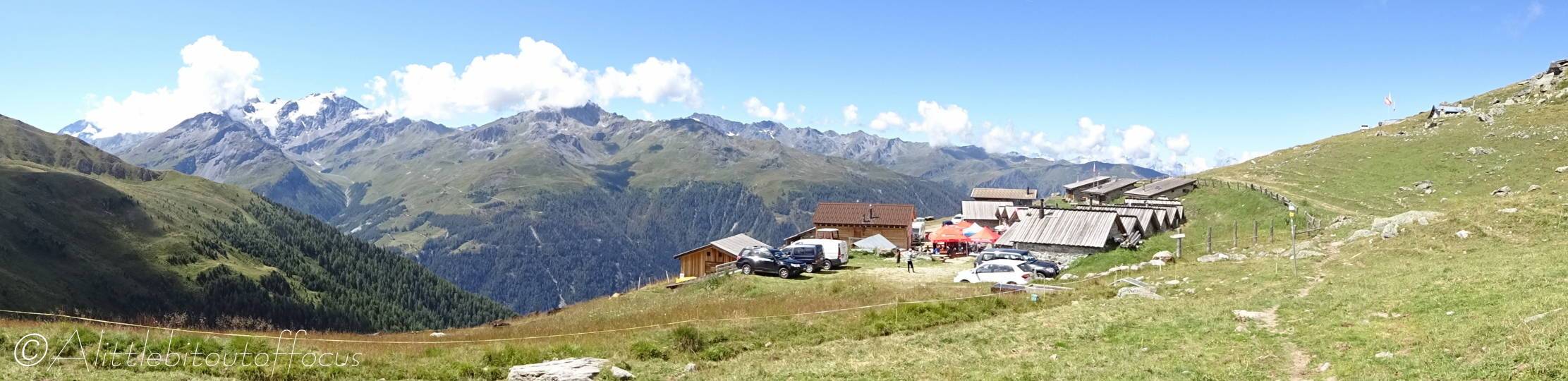
The buvette is usually open during the summer season, so it’s a great place to stop for a coffee or something stronger maybe on the way back. (The remaining loop starts and finishes here – with the return being the same way you came).
Take the path, which runs up towards the Pas de Lona (signposted), immediately passing a small chapel on the left. Again, the path is clear all the way to the col, though it does become very steep and gritty towards the crest. (Spare a thought for the Grand Raid mountain bikers who have to haul their bikes over this pass!) - Pas de Lona
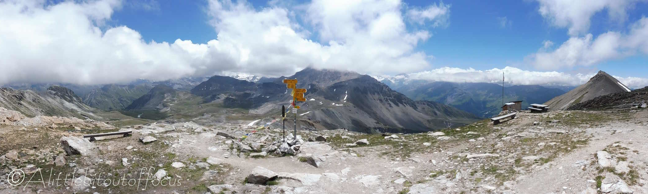
If legs are tired, then you can return the same way you came. Otherwise turn left at the col and follow the path up to the Cabane, which is visible just below and to the left of the Becs de Bossons. Keep and eye out for several clumps of Edelweiss, which seem to thrive along the crest. - Becs de Bossons cabane
The cabane is open for guests during the season (check their website – and book ahead if wanting to stay). It’s also a good place to stop for refreshments before continuing the walk.
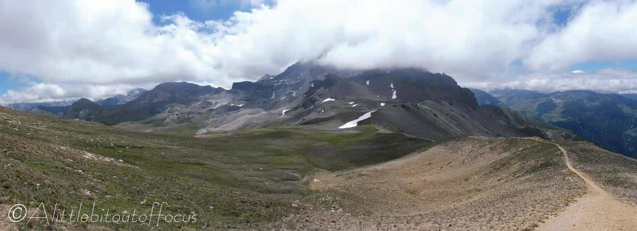
Again, you can return the same way you came, but to make this walk a little more interesting (and to ‘top’ 3,000 metres), it’s a relatively easy walk to the top of the Pointe de la Tsavelire (@3,025m) from the cabane. And, having got there (and taken in the 360 degree views), continue along the path down the other side, to a signpost indicating to go left to L’A Vieille. (The path continues on and down to the right into the Val de Réchy).
The path soon turns back left and, after another 140m or so, ignore the right turn to Lovegno (and ultimately St Martin) and go forward, down to another right then left turn. The path continues to L’A Vielle. - L’A Vielle (take 2)
Another opportunity to take a break, before retracing your steps back to Evolène.
Follow the service track down and take the path (signposted) as the track does a U turn back to the right. The path descends to cross the stream before climbing and undulating along the hillside and dropping down through the woods.
Turn right as you emerge from the woods, down to Volovron, then turn left back along the track and paths to Evolène.
