Outline Map:

Gallery:


Route Description:
Walk 28: Col de Torrent to Pointe du Tsaté ridge (Distance: 18.9 km and 1,810m ascent)
Although not officially marked on the map, it is possible to walk between the Col de Torrent and the pointe du Tsaté (or vice versa – though the way described here is probably easier to navigate). Although care needs to be taken along the ridge, it is more of a crest and there are no real precipitous drops. Note also that there is a ladder part way along the way. (See pic 5 above).
If the distance and/or height gain seem overwhelming, then an easier alternative is to start from Villa (perhaps after taking the postbus) and finish either there (by walking up the road from La Sage), or continue down to Evolène as described.
- From the via ferrata car park, just beyond the Co-op roundabout, walk between the chalets and turn right. The path winds up, eventually meeting a sign (where the via ferrata descent path meets the one you are on). Go right here and continue to ascend until you reach a cross track at a bench. Turn left here. The track bends up to the right and soon enters Villa.
- Villa
At the village road, turn right for 15m and then turn left at a huge signpost. The track ascends steeply, passing through some chalets. After zig-zagging left-right-left the track passes a few more chalets on the left before bending to the right. Straight ahead you will see a stream coming down. Keep to the right of the stream and up a path which crosses a wooden (single plank) bridge (see pic 4) and ascends again to the left. Soon you will reach a signpost. Turn right here towards the Mayens de Cotter / Col du Torrent (and National Walking Route 6). The path climbs to a single chalet overlooking the valley and meets a wide track. Turn right then immediately left here and traverse across a wide open meadow. The path bends to the left and climbs to 8 or 9 buildings at Mayens de Cotter. - Mayens de Cotter
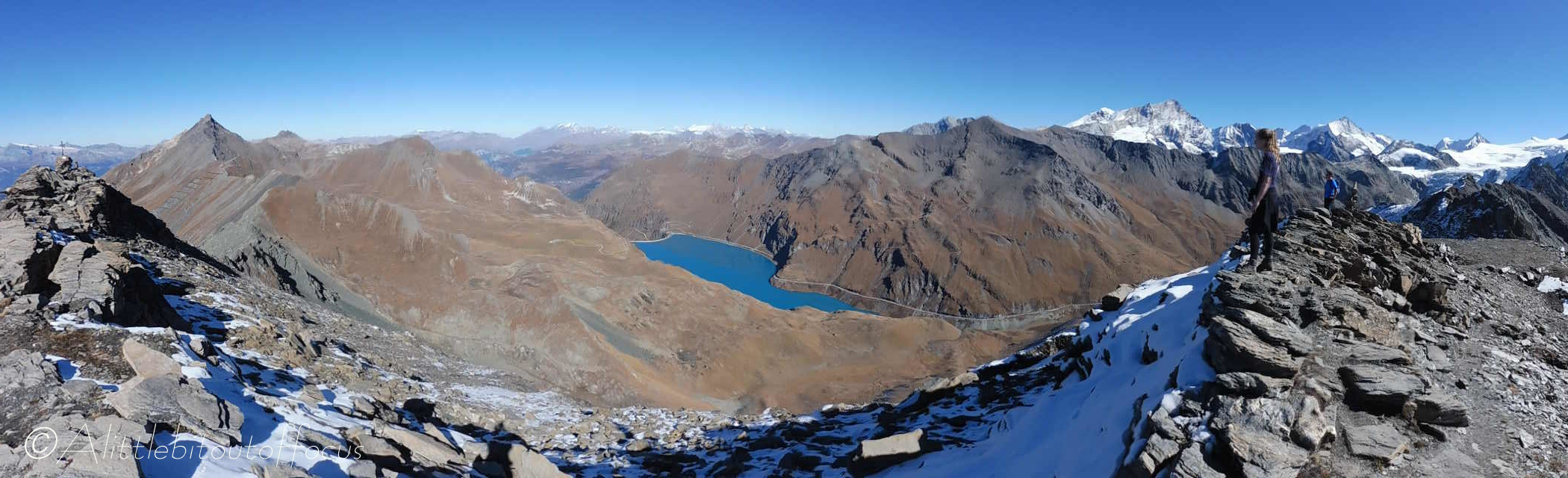
Turn left for about 30 metres along the track then take the path up to the right of a chalet. (Note that a water tap is usually available here). The path zig-zags up to the right then to the left and appears to be going too far left to be heading to the Col, but around 100m after a beige rocky outcrop, the path turns to the right and runs along a small elevated ridge. It then runs past a small lake (at Béplan) before ascending quite steeply again and ultimately around to the right and then left, quite steeply, up to the Col du Torrent. - Col du Torrent – Pointe du Tsaté ridge
At the col turn right and follow the path, initially along the ridge, but then as it drops down to the left to skirt below and around the large rocky outcrop effectively blocking the way. (Take care). Very soon it begins to rise again, up to the right, to an obvious looking ‘peak’. From here the route follows the line of a fairly wide crest.
Part way along you will need to climb a 12 rung ladder (fixed at the top). Again take care. Keep to the highest point (if only to get the best views in both directions). Again, you will meet a small ‘wall’ of rock (no ladder this time), go around this to left and continue along.
Gradually, the terrain will force you to drop to the right hand side of the ridge. Keep as high as you can so that you can regain the crest as soon as is practical to do so. Then continue along the ridge, scrambling up a steepish path to the final few metres to the pointe du Tsaté. - Pointe du Tsaté
There are two ‘high points’. The first is the official summit, @3,077m, (since it has the metal cross), but you will pass by there to the 2nd. which has (or had) a rather attractive stack of stones. From both the views are magnificent.
The descent path continues off and slightly to the right and passes to the left of some avalanche metalwork. From here you pass a temporary building to the left (if it’s still there) and you will see a ridge falling away directly in front. follow this ridge down for maybe 400metres before turning left along a path which zig-zags down to a small lake, called Lac du Tsaté. Turn right and follow the path down to the farm buildings at Remointse du Tsaté.
Note that there is another small lake just above the buildings to the left (possibly noticed during your descent). Feel free to detour up and take photos, as the reflections of the mountains can be stunning. - Remointse du Tsaté
The path continues past the long farm building before dropping down and around to the right. The path finally turns left down to a small building just below the intersection with a wide track. Follow the path down to the left of the building, almost directly downhill to Tsalè du Tsaté, where there is a signpost (indicating the way down to La Forclaz and Les Haudères). - Tsalè de Tsaté
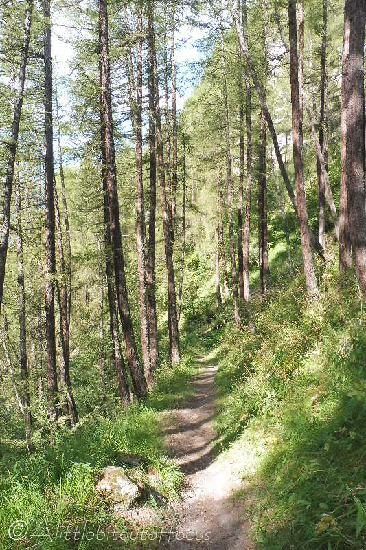
Cross over the track, slightly to the left, and follow the path down to the right of some buildings and a small stream. At a wooden cross it turns off to the right and then bends back to the left and down quite steeply, through some trees, eventually reaching a stream.
Cross the stream and follow the wide track to the right of some buildings (Mayens de Motau). Follow the sign to La Forclaz and La Sage. The path goes to the right of the rightmost building and descends to a track. Note: Keep to the higher path as it bends to the left (as indicated by the arrow on a stone). Turn left along the (often rather wet) track to a man-made track/road at a U bend and then turn right.
After about 20m, a path goes off to the right and descends across a field to another track/road. Turn right and follow it, as it descends steeply before winding back down to the left (towards La Forclaz). Part way down you will see a track going off to the right (signposted). Follow this track as it descends into La Sage. - La Sage
Turn right along the road. Refreshments are generally available at L’Ecureuil restaurant (or Les Collines a few metres further up the road on the left). Turn left down the road just after the L’Ecureuil and follow it down an S set of bends past the Hotel de la Sage.
The road bends around to the left and you will see a signpost indicating the way to the Chappelle St Christophe. (Feel free to detour). There are now 2 options:
i) take the path almost opposite, it runs down a field to the right of stream to meet a track and then turn right, or
ii) continue down the road to an obvious (signposted) road/track to the right and turn down there.
Follow this track all the way down as it bends around to the right and descends through the woods to La Tour. Turn right, passing some new chalets on the left and going between some other chalets to a side road. Turn left then almost immediately right to reach Evolène.
