Outline Map:
Gallery:


Route Description:
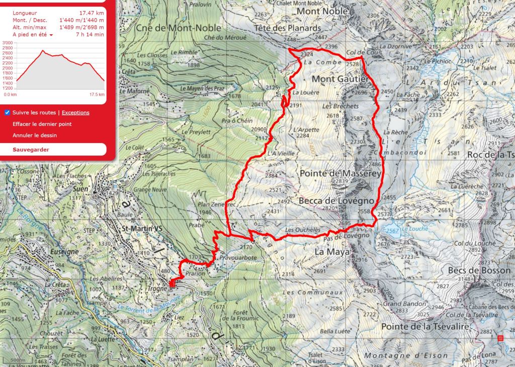
Walk 25: Val de Réchy (Distance: 17.5 km and 1,440m ascent)
As mentioned in the Overview, this walk takes you into a very peaceful, unspoilt valley. It’s a circular walk from the small village of Trogne, where there is a small parking area just as you are leaving the village (in the direction of Eison) on the right hand side.
It is recommended that you take note of the key junctions during the ascent to the Farm (i.e. sections 1 and 2), as the descent, back down the same path is not described below.
- From the parking bays, walk back down the road and, before the road swings around to the right, there’s a track going up on the right hand side. Turn right here for no more than 50 metres and the path doubles back to the right and begins to ascend to the left hand side of a chalet. Very soon it meets a track. Turn left and follow this around the bend before ascending again to the left and passing two more chalets on the right. Less than 100m further, the path passes to the right of another chalet and then turns left and goes up behind it. Almost directly behind the chalet, the path goes off to the right.
The path zig-zags up and passes some buildings on the left before zig-zagging again up to a wide track. Turn right here and after only 7o metres, follow the path up to the left along the line of a small stream (past a chalet on the right).
The path now goes directly up to the left, at the edge of a wood and crossing tracks, arriving at a group of 5 or 6 chalets at Pravouarbote. - Pravouarbote
Go around the bend in the track and, after a small shrine on the left, turn upwards to the right, (signposted), across a meadow and into the woods. Turn right at a track then up left, by the side of a chalet. The path bends around to the left before coming to another small shrine and then heading up towards the left across a meadow and into the woods.
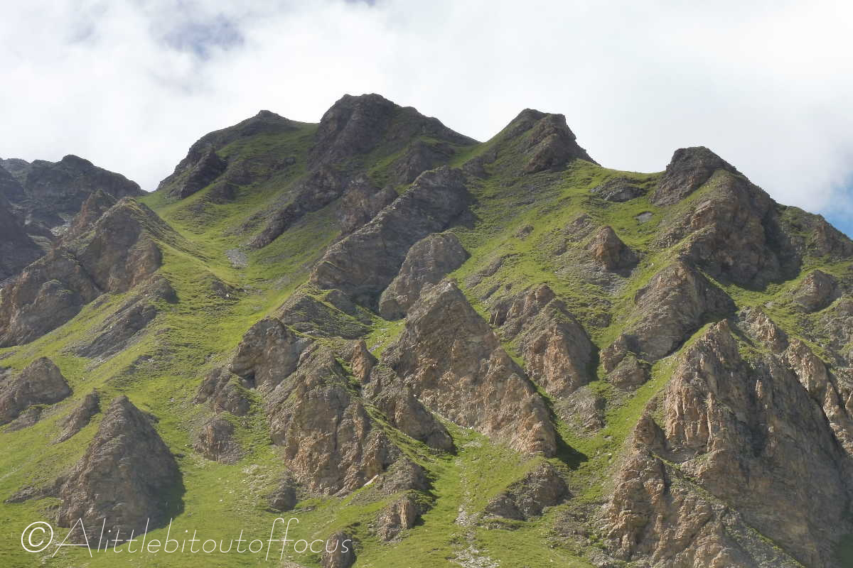
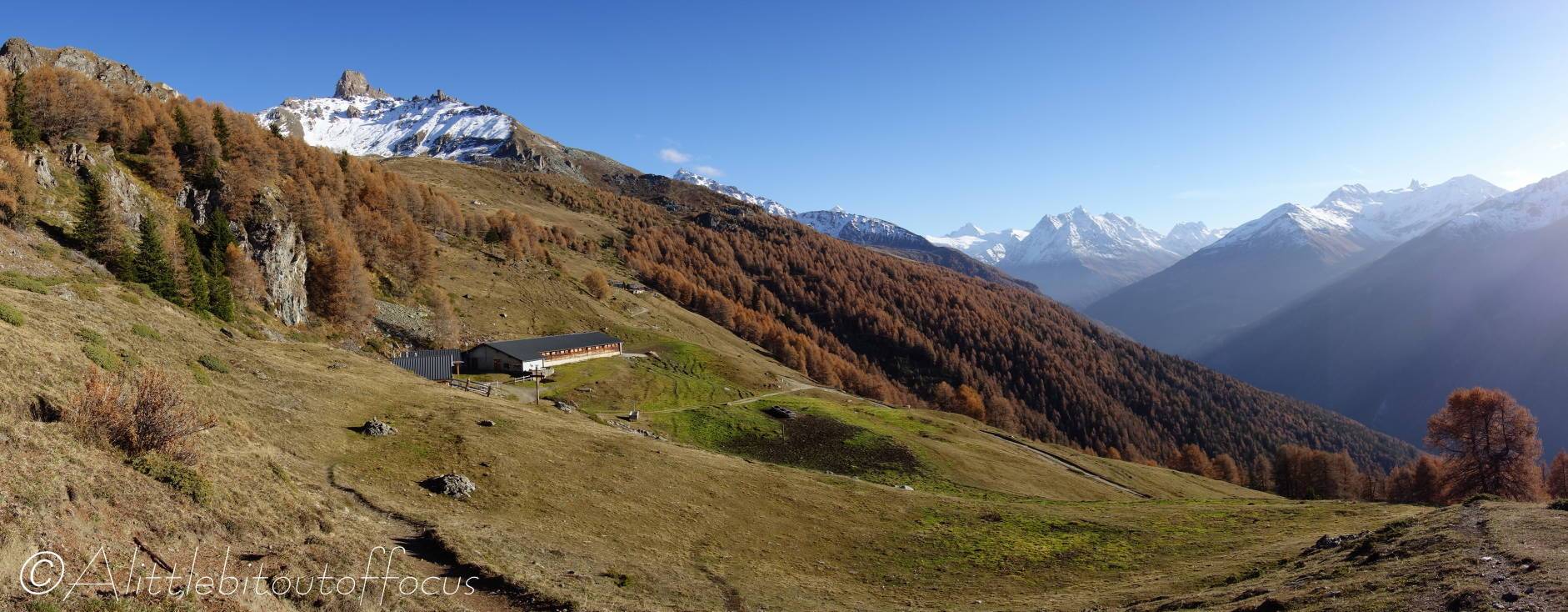
Follow the path continuing upwards through the woods until it emerges and you will see a farm straight ahead. (See pic 2). Follow the path up to this farm. (Note, this is the path you will drop down to later*). - Farm
As you approach the farm, you meet a track coming in from the left. Cross over this track and take the path which goes off and up to the left (at about 45 degrees). A little over 150m further on, turn right up another path to the Pas de Lovégno. (The way is signposted I think). The route up is now quite clear to the col. - Pas de Lovégno
Up to the left of the col is the Becca de Lovégno (@2,821m). If you are feeling energetic, it provides wonderful views over the valley. Indeed, it is possible to follow the line of the ridge (with care) all the way to the Col de Cou. But I digress…
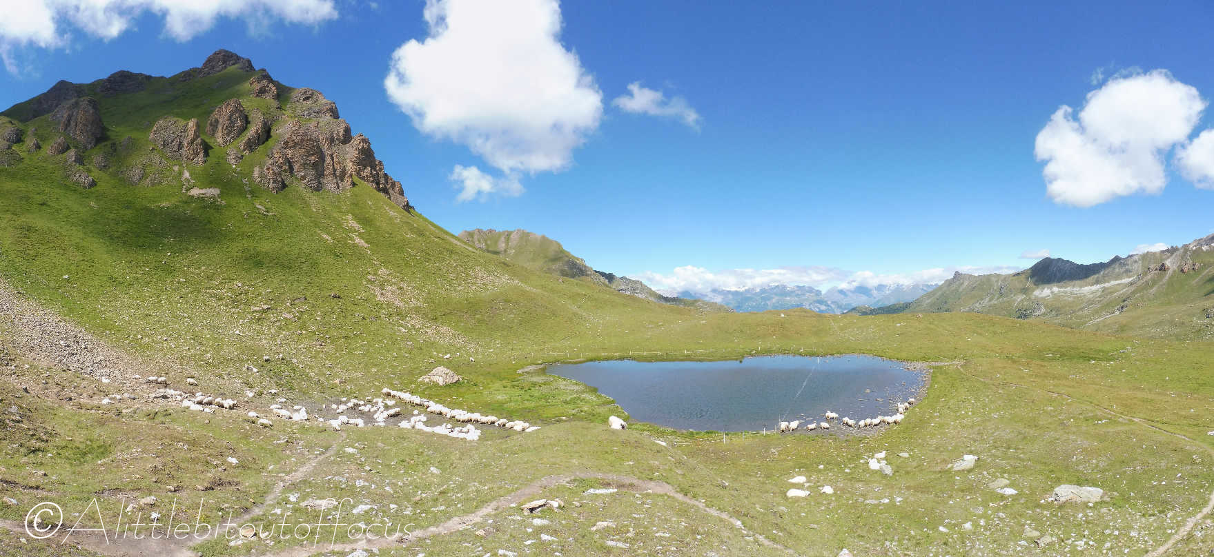
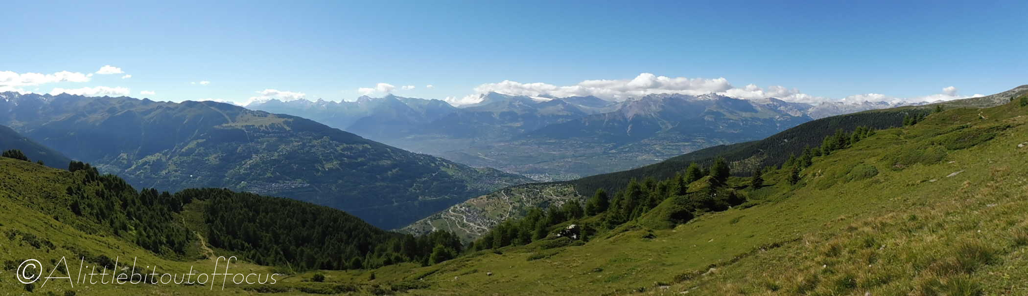
From the col, continue down into the Val de Réchy (ignore the path off to the right to the Becs de Bosson). Very soon you will be rewarded with a fabulous view down the valley and of lake Le Louché. Feel free to visit the lake, but, before you get there, to the left, there is a signpost, indicating the way to go, slightly downhill and along the left (west) side of the valley.
After around 200m, the path splits. Keep to the left hand path. One kilometre further on you will reach the Gouille (or pond) de Potoc. (See pic 7 above). Again, keep to the left hand side and follow the obvious path all the way (almost 2 km) to the Col de Cou. - Col de Cou
At the col, continue on and descend into the Val d’Hérens. Again the path is quite clear. You will pass a signpost and the path joins a track which goes under the ski lift. You can either follow the line of the lift down (very steeply) to the same track and turn left, or continue along the track – it bends to the left and goes back under the ski lift.
Follow the track down for a further 500m and you will see the very welcome sight of the Gîte de la Louère, (which is normally open in the summer season for refreshments). Either follow the track down as it goes right then left, or take a more direct route down an unofficial path, which cuts off the corner. - Gîte de la Louère
Continue along the wide service track which runs away from the end of the building. After 700m, as the road U bends back to the right, take the path which goes off more or less straight ahead/to the left of the track. The path soon turns left then right as it crosses a stream. Follow this path (for 1.8km) until you see the farm buildings at Alpage de Lovégno, ignoring the left turn after around 700m. - Alpage de Lovégno
Once you see the farm, you can;
either continue along the path and then tracks to the farm mentioned in Section 3 above and take the path down which you ascended earlier,
or take a suitably safe direct line down the slope to meet the cross path which you ascended earlier (and mentioned in Section 2 above*). - Once on the same ascent path, retrace your route back to Trogne and the parking bays.
