Outline Map:

Gallery:


Route Description:
Walk 7: Ferpecle Valley Walk (Distance: 4.6 km & 200m ascent)
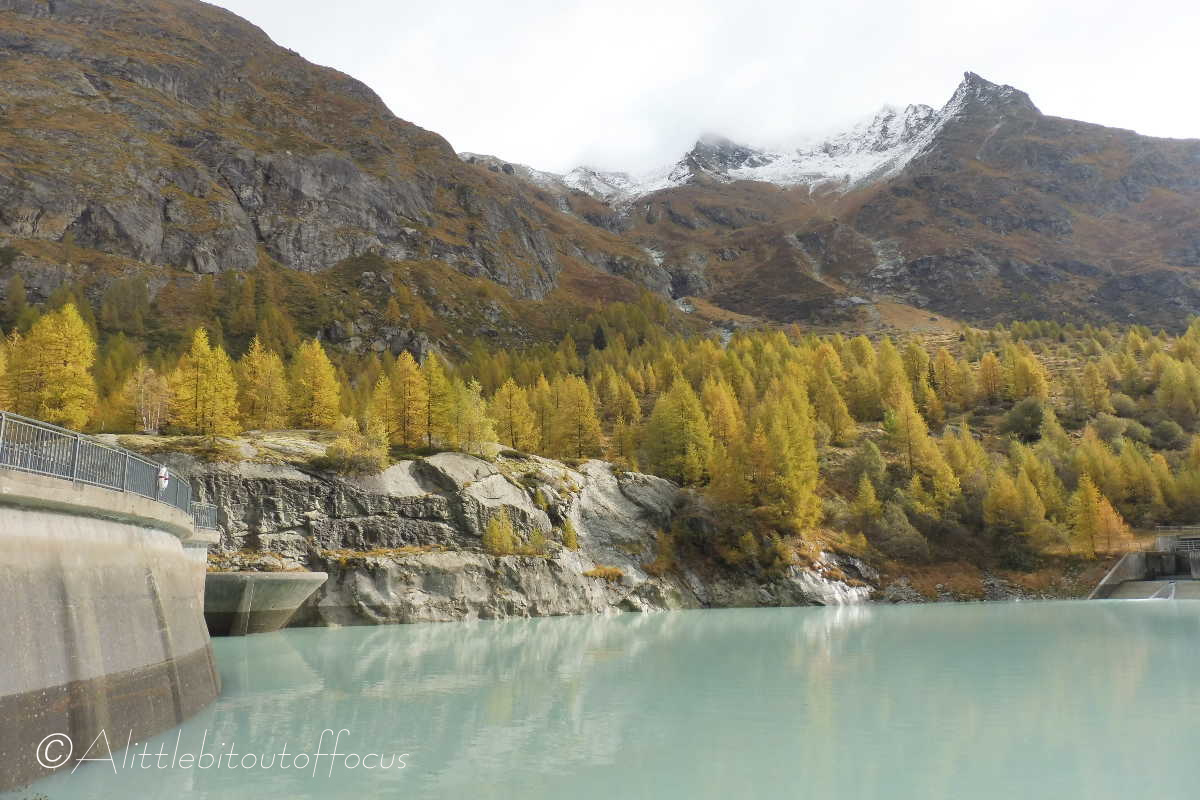
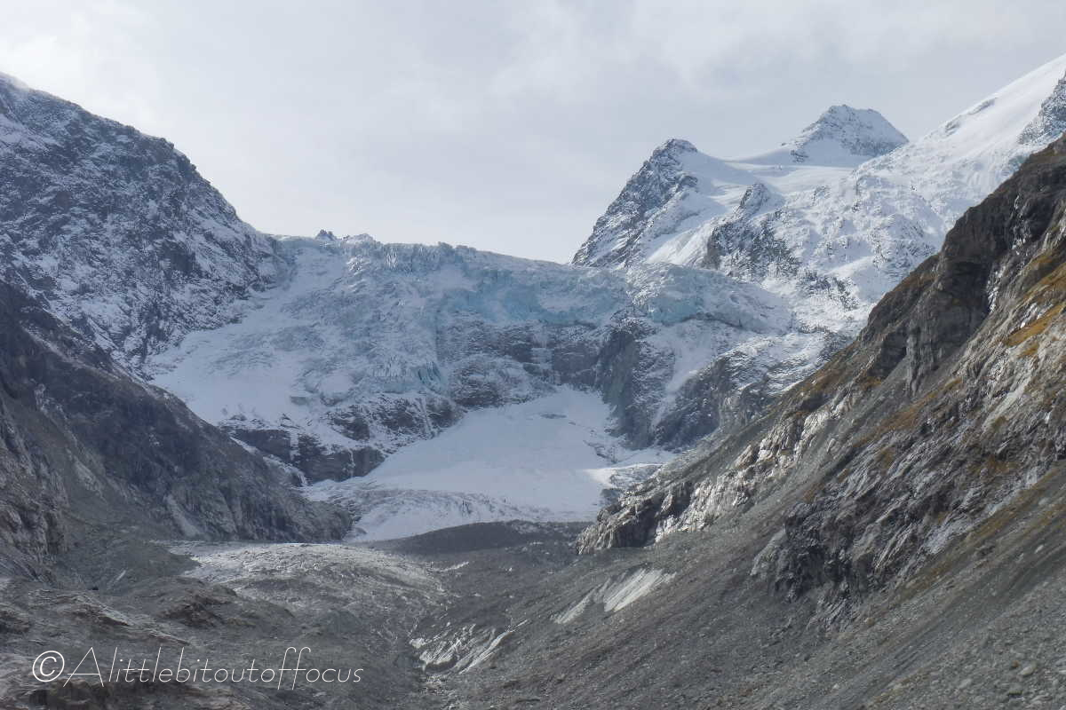
This is a very easy and pleasant walk which gives fabulous views of the Ferpècle valley and the Mont Miné glacier.
Note: The walk starts from the small parking area at a copse of trees, just beyond Le Salay, where the road bends 180 degrees to the left. DO NOT drive or park beyond this point, as the rest of the road is Private and you may be fined for using it without authorisation.
- From the copse of trees/parking area mentioned above (see also map overleaf), continue up the zigzag in the road, passing a small café on the right (open in summer), until it crosses a small stream and bends to the right. After another 80 metres the track turns left to a small dam and reservoir.
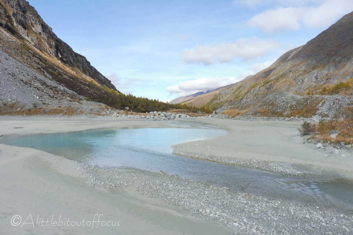
From the reservoir take the wide and rough stony track which runs slightly upwards to the right and towards the end of the valley. This meanders left (passing a picnic area) then right, then left, then right again. Keep to the track and eventually you will reach a small pond on the left. From here you have 2 choices – either:
a) continue forwards along a path which descends and crosses a stream, then rises again and continues forward on the other side, or
b) (as per the map) turn right along the track and follow it around to the left until you meet an information board, where you can turn left.
Both options take you to a large bridge over the river where the path will return you to just below the reservoir. (See 5 below). - If you wish to explore the valley floor further, then continue along the track on the right hand side of the river.
- Alternatively you can cross the bridge and turn immediately right (taking care over the rocks if wet). Follow the path along the left hand side of the river.
Note that it is not possible to cross the river from the left bank to right, or the right bank to the left, (at least not without wading through icy cold water, which is not recommended! - After walking as far as you wish (up either side of the river) and exploring the valley, you can return the same way that you came or, (as described here), follow the path back down to the right of the valley (heading downhill).
- From the wooden bridge, walk with the river on your left for about 30 to 40 metres and you should see a path going off to the right (almost immediately after a shallow stream coming in from the right). Follow this path upwards, passing a small shack off to your left. The path bends left and eventually meets a signpost, indicating the way up to the Bricola hut and the way back (left) to the car parking area. Follow this path down as it heads a little left before bending to the right and taking you back to the track, just below the reservoir. Turn right and follow the track/road back to the car park.
