Outline Map:
Gallery:


Route Description:
Walk 30: Col de Bréona and Col du Tsaté (12.6 km and 1,275m of ascent)
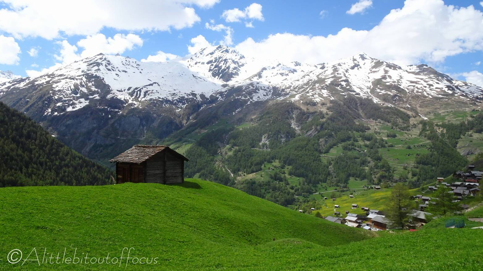
This walk gives fantastic views of the Dent Blanche and the Ferpècle glacier before ascending to the the Col de Bréona and then along the edge of the ridge to the Col du Tsaté.
- From the car park in La Forclaz, walk down the road which heads towards the end of the valley and which goes off to the left of the Hotel Le Grenier, signposted to the Mayens and Col de Bréona. The tarmac road soon turns into a man-made farm track and starts to ascend. As you approach the trees, at a sharp left hand bend, the path goes off to the right, cutting off the corner of the track.
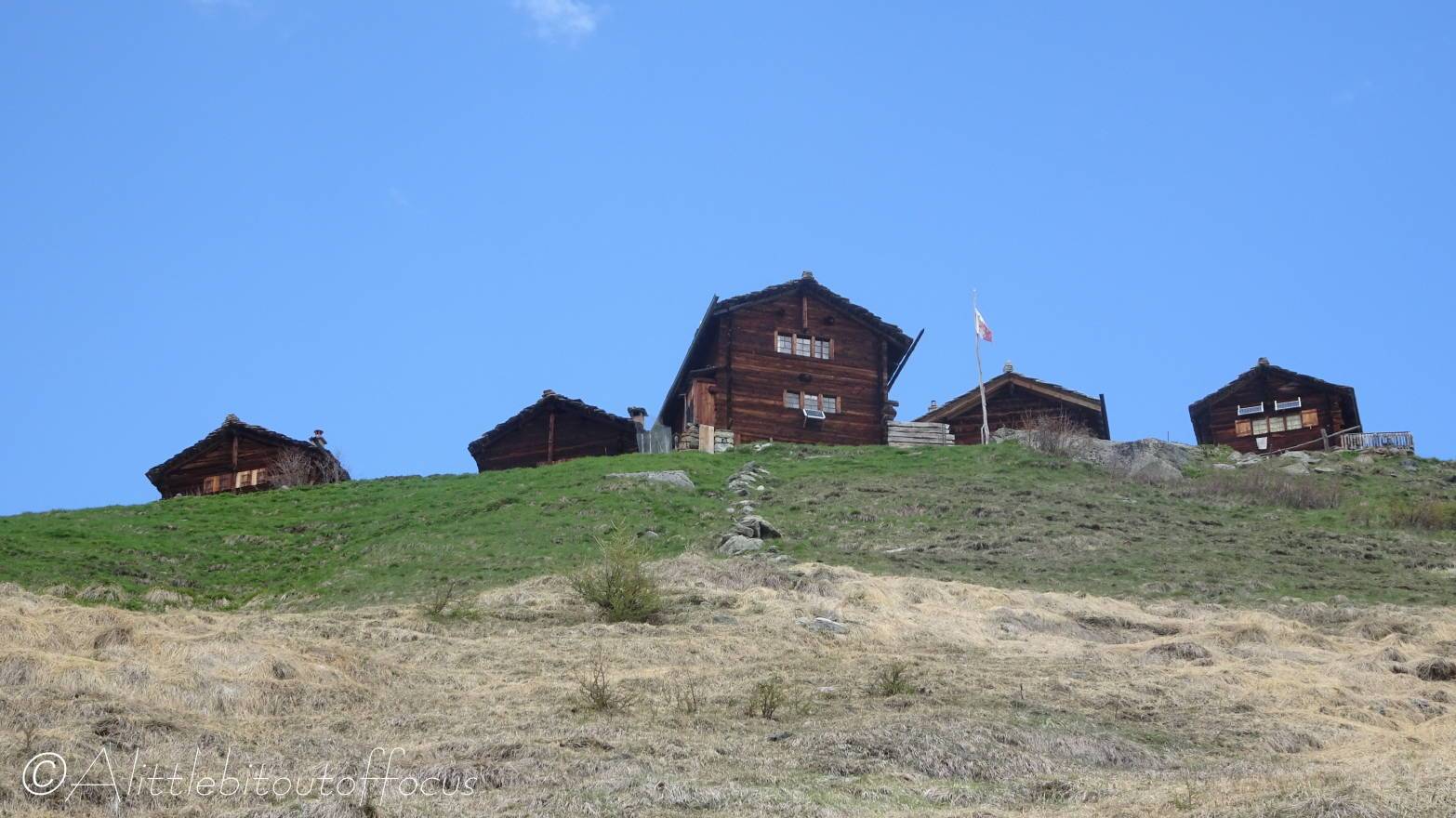
When you meet the track again, go right for 10m and then turn left up a steep path. You will meet the track again on a sharp bend. Walk up the track to the next bend (with a bench on the right hand side), the path goes off immediately to the left of the track straight ahead (just after the tree stump). The path rises quite steeply and crosses the track once more. Soon the path reaches 3 wooden chalets and goes up between them. - Three chalets
Once through the chalets, the path immediately turns to the right and meets the farm track once more. Turn left here for 50m and then take the path up to the right. At the track, turn right for 10m and then take the path on the left. It now zig-zags upwards towards a row of 4 chalets at Mayens de Bréona. At a track, cross slightly to the left and continue upwards to the chalets. - Mayens de Bréona (2087m).
Note: Drinking water usually available here,
At the signpost turn right, as indicated, to the Col de Bréona. The path zigzags up between some more chalets to another signpost. Turn right here along a wide track which meanders upwards. Just above some more buildings and a wooden cross, turn right and almost immediately the track U bends to the left.
You can keep following the track or take yet another shortcut by heading directly uphill on this corner, cutting across open fields, initially to the left side of a stream then crossing it to reach the original track cutting across from left to right. Turn right along the track for quite some way until you see an obvious path going up to the left. (This is about 400m before the buildings at Remointse de Bréona). Turn left up this path as it cuts diagonally across. Soon it levels out then climbs steadily, (sometimes steeply), to the col. - Col de Bréona
Note: Please take care along this stretch…
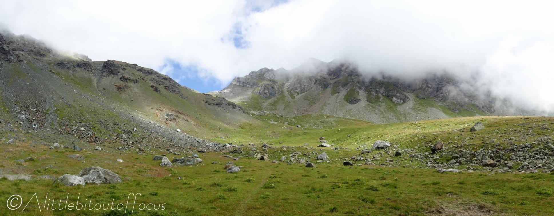
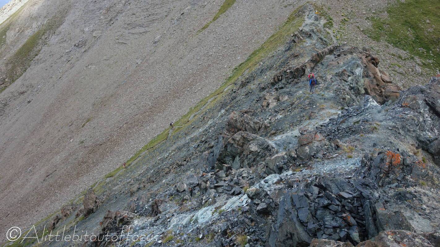
After taking in the views, ascend the peak to the left of the col. From here you can see the Col du Tsaté with the Pointe du Bandon above. Turn right and look for a rocky path down to the right of the ridge. The route becomes a little indistinct and drops a little further. (Note: this is not too much of an issue as the Col du Tsaté is 50m lower then the Col de Bréona, but do not descend too far). The way looks to be barred by rocks, but soon you will find a way around. Then traverse around to the left, crossing more loose rock until you regain a good path, which goes along and down to the Col du Tsaté. - Col du Tsaté
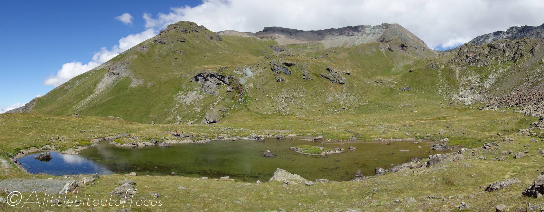
At the col there is a signpost, but the way down is clear… (to the left as you approached the col). As you descend, you will see a small lake at the Remointse de Tsaté. The lake is well worth a very short detour.
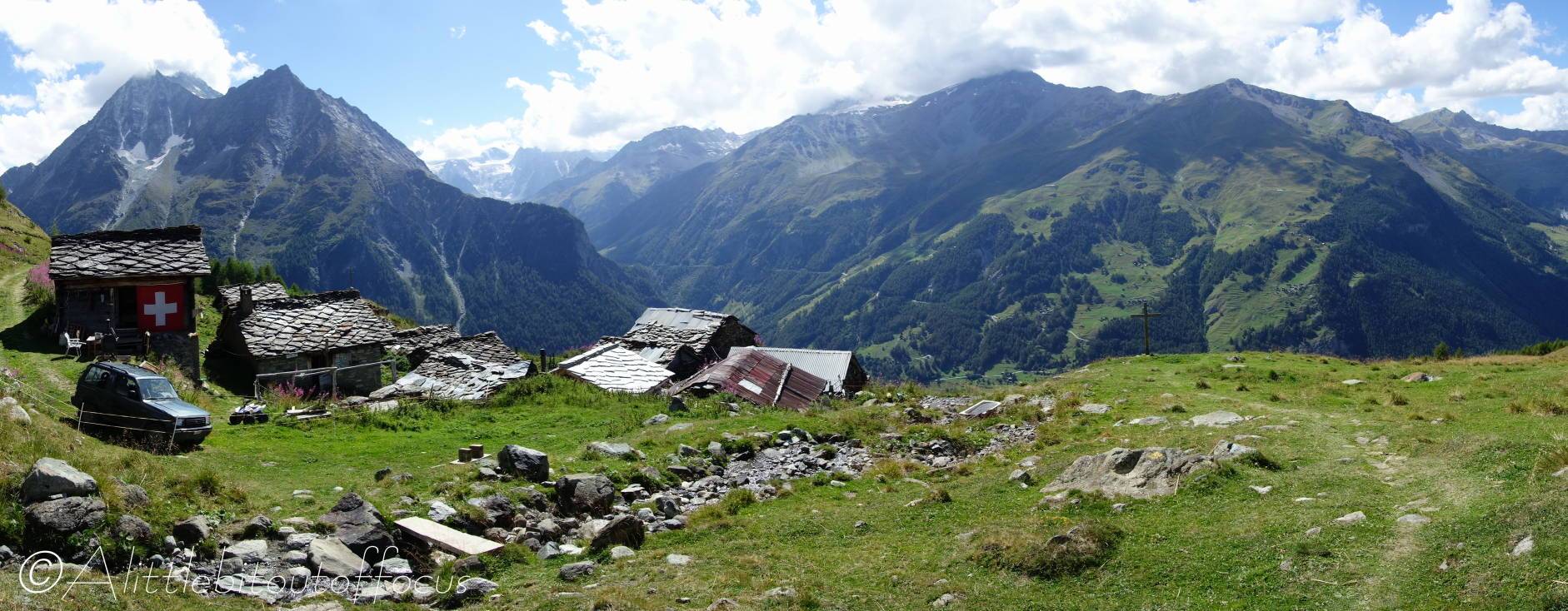
From the lake turn to the right and drop down (either directly, or, if wet…) towards the left and across a stream to the farm building. - Remointse du Tsaté
The path down continues along the left of the farm building before dropping down and around to the right. The path finally turns left down to a small building just below the intersection with a wide track. Follow the path down to the left of the building, almost directly downhill to Tsalè du Tsaté, where there is a signpost (indicating the way down to La Forclaz and Les Haudères). - Tsalè de Tsaté
Cross over the track, slightly to the left, and follow the path down to the right of some buildings and a small stream. At a wooden cross it turns off to the right and then bends back to the left and down quite steeply, through some trees, eventually reaching a stream.
Cross the stream and follow the wide track to the right of some buildings (Motau). Follow the sign to La Forclaz and La Sage. The path goes to the right of the rightmost building and descends to a track.
Note: Keep to the higher path as it bends to the left (as indicated by the arrow on a stone). Turn left along the (often rather wet) track to a man-made track/road at a U bend and then turn right.
After only about 20m, a path goes off to the right and drops down a field to another track/road.
Either cross directly over the track and descend through some chalets to the track which goes left down into La Forclaz,
or, turn right and follow the track down as it U bends to the left and then continues all the way down into La Forclaz.
